Export Lecture
| Seminar Lab Date | Seminar Lab Location | Seminar Lab presenter | Seminar Lab presenter 1 | Seminar Lab Subject | Seminar Lab Details |
|---|---|---|---|---|---|
| 09/28/15 |
Location: University of Minnesota East Bank campus,
Kenneth Keller Hall, 200 Union St. SE, Minneapolis MN 55455 Room 3-210. MAP. |
Karl Wirth, Ph.D., Geology Department, Macalester College | Telling Time: How Geologists Work With Deep Time | ||
| 09/14/15 |
Fall Banquet, Annual Meeting, and Lecture
Location: U Garden Restaurant, 2725 University Ave. SE, Minneapolis Dinner 5:00-7:00 PM; Annual Meeting 7:00; Lecture follows ~7:15, map on web site. |
Justin Tweet, M.Sc, Tweet Paleo-Consulting | Paleontology of the National Parks of the Colorado Plateau | ||
| 01/25/16 |
Location: University of Minnesota East Bank campus,
Kenneth Keller Hall, 200 Union St. SE, Minneapolis MN 55455 Room 3-210. MAP |
Harvey Thorleifson, Ph.D., Minnesota Geological Survey | Where Diamonds Come from and Where They Are Going | ||
| 02/08/16 |
Location: University of Minnesota East Bank campus,
Kenneth Keller Hall, 200 Union St. SE, Minneapolis MN 55455 Room 3-210. MAP |
Peter Hudleston, Ph.D., Dept. of Earth Sciences, University of Minnesota | Iceland: a Cold Geological Hot Spot | ||
| 02/20/16 |
Location: Macalester College
Olin-Rice Science Center (south end of campus, by tennis courts) Geology Dept. is in SW area of basement. Building 14 on Campus Map Road Map |
Conducted by Jeff Thole, M.Sc., Macalester College | CSI Mineralogy – Using Photons, Electrons and X-rays to Investigate Geologic Unknowns | ||
| 02/22/16 |
Location: University of Minnesota East Bank campus,
Kenneth Keller Hall, 200 Union St. SE, Minneapolis MN 55455 Room 3-210. MAP |
Justin Revenaugh, PhD, Professor of Geophysics, University of Minnesota | Shouts and Murmurs: Eavesdropping on Earth | ||
| 03/07/16 |
Location: University of Minnesota East Bank campus,
Kenneth Keller Hall, 200 Union St. SE, Minneapolis MN 55455 Room 3-210. MAP |
Baseline Water Quality in Three Northeastern Minnesota Watersheds | Perry Jones, M.Sc., Minnesota Water Science Center, United States Geological Survey | Assessing the Influence of Copper-Nickel-Bearing Bedrock on | |
| 03/21/16 |
Location: University of Minnesota East Bank campus,
Kenneth Keller Hall, 200 Union St. SE, Minneapolis MN 55455 Room 3-210. MAP |
Kent Kirkby, Ph.D., Dept. of Earth Sciences, University of Minnesota | Volcanoes and Our Past | ||
| 04/04/16 |
Location: University of Minnesota East Bank campus,
Kenneth Keller Hall, 200 Union St. SE, Minneapolis MN 55455 Room 3-210. MAP |
William Cordua, Ph.D., Geology Emeritus, University of Wisconsin, River Falls | Wisconsin Wild Minerals | ||
| 04/18/16 |
Location: University of Minnesota East Bank campus,
Kenneth Keller Hall, 200 Union St. SE, Minneapolis MN 55455 Room 3-210. MAP |
How Tiny Minerals Answer Big Questions about Alaska Geology | Cameron Davidson, Ph.D., Professor of Geology, Carleton College | Was Southern Alaska Once Part of California? - | |
| 05/02/16 |
Fall Banquet, Annual Meeting, and Lecture
Location: U Garden Restaurant 2725 University Ave. SE, Minneapolis Dinner 5:00-7:00 PM; Annual Meeting 7:00; Lecture follows ~7:15 Map
|
Mark Jirsa, M.Sc., Minnesota Geological Survey | Have Canoe, Will Travel: Geology of the Boundary Waters Canoe Area Wilderness | ||
| 11/21/16 |
Location: University of Minnesota East Bank campus, |
Paul Morin, Director/Principal Investigator, | Polar Geospatial Center, University of Minnesota | Polar Research – Geology and the Ends of the Earth: The High-Resolution Imagery Revolution | |
| 10/10/16 |
Location: University of Minnesota East Bank campus, |
Justin Revenaugh, PhD, Professor of Geophysics, University of Minnesota | Shouts and Murmurs: Eavesdropping on Earth | ||
| 10/24/16 |
Location: University of Minnesota East Bank campus, |
Chris Elvrum, M.Sc | Professional Geologist, Minnesota Department of Health | Protecting Groundwater: Minnesota’s Primary Drinking Water Source | |
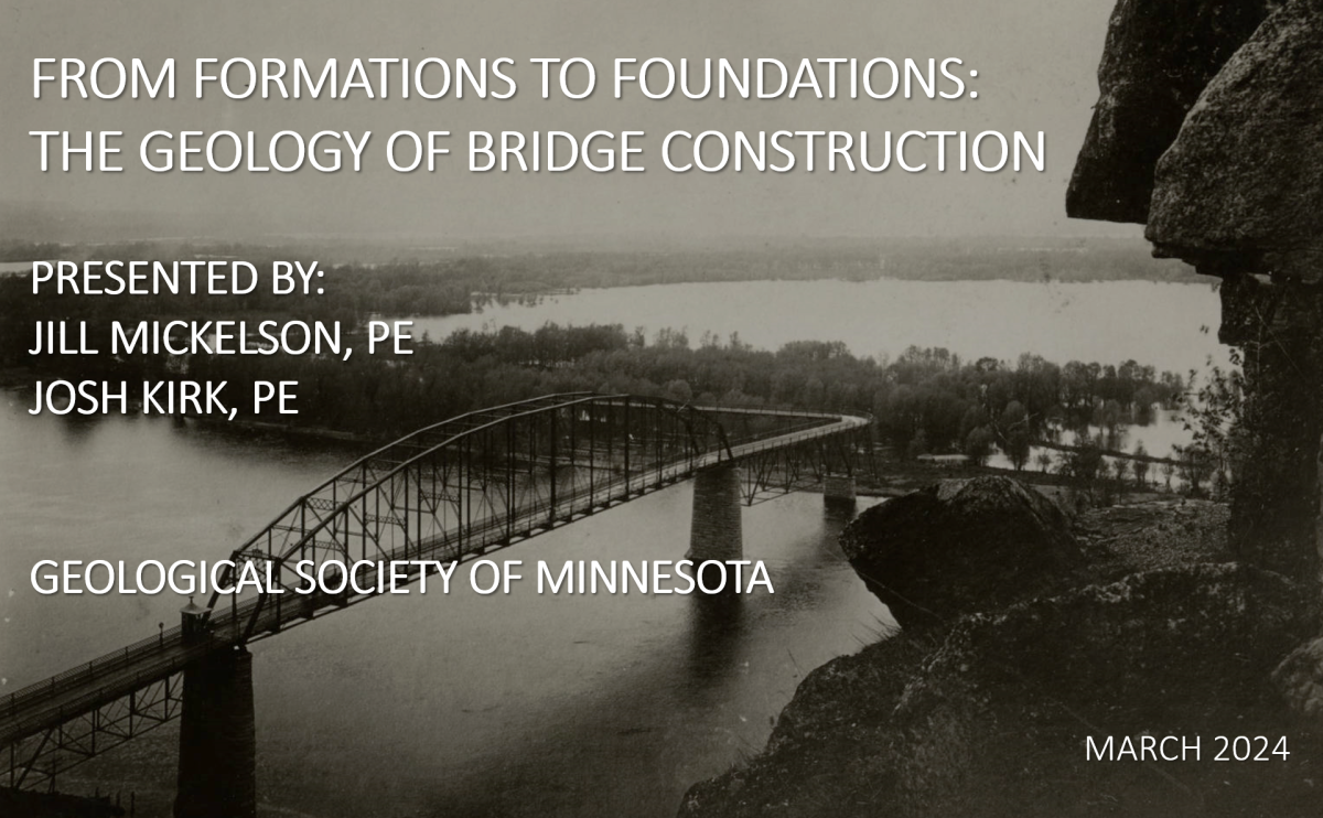
| 12/05/16 |
Location: University of Minnesota East Bank campus, |
Joe Hudak, MnDOT Assistant Engineering Geologist & Paul Kivisto | St. Croix Crossing Bridge Construction Engineer | Bridging the Geological Features of the St. Croix River Valley | |
| 11/07/16 |
Location: University of Minnesota East Bank campus, |
Jake Dalbec, B.Sc., Professional Geologist | American Engineering Testing, Inc. | Arizona Rocks and Outcrops | |
| 09/12/16 |
Location: U Garden Restaurant
2725 University Avenue SE Minneapolis, Minnesota, 612-378-1255 Go to www.ugardenrestaurant.com for directions |
Kate Clover is a program manager, geo-science educator and sand curator | Science Museum of Minnesota | The Wondrous World of Carbonate Sands | |
| 09/26/16 |
Location: University of Minnesota East Bank campus, |
Leif Johnson, M.Sc., Barr Engineering | Thar be Fe & Mn in 'dem dar' hills! A mining history and geology of the Cuyuna Iron Range | ||
| 02/06/17 |
Location: University of Minnesota East Bank campus, |
Randy Strobel, Ph.D., Metropolitan State University | Geology of the Mississippi River Gorge of the Twin Cities | ||
| 01/23/17 |
Location: University of Minnesota East Bank campus,
Kenneth Keller Hall, 200 Union St. SE, Minneapolis MN 55455 Room 3-230. MAP Note: this is the lecture room adjacent to the room used for the Fall 2016 seminars |
Alan Chapman, Macalester | Mantle Hunting in Arizona | ||
| 02/20/17 |
Location: University of Minnesota East Bank campus, |
Prof. Thomas Hickson, University of St. Thomas | What Would The Rock Evidence for Martian Life Look Like? Microbialites: Rocks From Microbes | ||
| 03/06/17 |
Location: University of Minnesota East Bank campus, |
Chris H. Crosby, PhD, Bailey Geobiology Research Group, University of Minnesota | Stones and bones and… fossil embryos? Calcium phosphate minerals as a nexus between geology and biology | ||
| 03/20/17 |
Location: University of Minnesota East Bank campus, |
Brian Lentz, Big Rock Exploration Company (Minneapolis) | Strategic Minerals - What are they & Why should I care? | ||
| 04/03/17 |
Location: University of Minnesota East Bank campus, |
John Westgaard, Science Museum of Minnesota | Fossils on the Iron Range | ||
| 04/17/17 |
Location: University of Minnesota East Bank campus, |
Howard Hobbs, Minnesota Geological Survey (retired) | Minnesota Glacial Geology in Song and Story | ||
| 05/01/17 |
Spring Banquet & Lecture, |
Steve Erickson, M.Sc. | "Boom Times, The Early Days of the Oklahoma Oil Industry" | ||
| 09/28/15 |
Location: University of Minnesota East Bank campus, |
Karl Wirth, Ph.D., Geology Department, Macalester College | Telling Time: How Geologists Work With Deep Time | ||
| 10/12/15 |
Location: University of Minnesota East Bank campus, |
Mark Seeley, Ph.D., Dept of Soil, Water & Climate, University of Minnesota | Climate Change in Our Backyards | ||
| 10/26/15 |
Location: University of Minnesota East Bank campus, |
James Almendinger, Ph.D., Senior Scientist, St. Croix Watershed Research Station, Science | Basic Groundwater and Surface Water Interactions in the Twin Cities | ||
| 11/09/15 |
Location: University of Minnesota East Bank campus, |
Bill Seyfried, Ph.D. | Dept. of Earth Sciences, University of Minnesota | An ‘In-Depth’ Look at Oceanography | |
| 11/23/15 |
Location: University of Minnesota East Bank campus, |
Carrie Jennings, Ph.D. | Minnesota Dept. of Natural Resources | A Slippery Slope: Towards Better Understanding and Prediction of At-Risk Hillsides | |
| 12/07/15 |
Location: University of Minnesota East Bank campus, |
Robert Gehrz, Ph.D. | Dept. of Astronomy, University of Minnesota; Director of University of Minnesota Observatories | A Tour of the Solar System | |
| 09/18/17 |
Fall Banquet, Annual Meeting, and Lecture |
Joe Eastman, Ph.D., Prof. Emeritus of Anatomy, Ohio University | Historical Perspective on the Evolution of Antarctic Fauna | ||
| 10/02/17 |
Location: University of Minnesota East Bank campus, |
Kristi Curry Rogers, Ph.D., Geology Department, Macalester College | Questions about Dinosaurs | ||
| 10/16/17 |
Location: University of Minnesota East Bank campus, |
James Magnuson, Minnesota Mineral Club, Author of Agate Hunting Made Easy | Agate Hunting Made Easy | ||
| 10/30/17 |
Location: University of Minnesota East Bank campus, |
Jeffrey Lipovetz, BS, TKDA Engineering, Saint Paul, MN | The Pros and Cons of Mining | ||
| 11/13/17 |
Location: University of Minnesota East Bank campus, |
Val W. Chandler, Ph.D., Minnesota Geological Survey | One Century and Counting: The Use of Geophysical Methods to Explore the Unseen Geology of Minnesota | ||
| 11/27/17 |
Location: University of Minnesota East Bank campus, |
Andrew Wickert, PhD, Department of Earth Sciences, Newton Horace Winchell School of Earth Sciences, UOM | Minnesota: A History of Ice, Rivers, and Landscape Change | ||
| 12/11/17 |
Location: University of Minnesota East Bank campus, |
Cynthia Cattell, PhD, School of Physics and Astronomy, University of Minnesota | What is Space Weather (and Why Should You Care)? | ||
| 01/22/18 |
Location: University of Minnesota East Bank campus, |
Joshua Feinberg, Ph.D., Dept. of Earth Sciences, University of Minnesota | The Minnesota Mineral Collection ****** Postponed until 1/29 because of snow storm. ********* | ||
| 01/29/18 |
Location: University of Minnesota East Bank campus, |
Joshua Feinberg, Ph.D., Dept. of Earth Sciences, University of Minnesota | The Minnesota Mineral Collection ****** Reschedule from 1/22 because of snow storm. ********* | ||
| 02/19/18 |
Location: University of Minnesota East Bank campus, |
Katherine Marshall, MS, Minnesota Geological Survey | Glacial Geology of Washington State | ||
| 02/05/18 |
Location: University of Minnesota East Bank campus, |
Julia Steenberg, MS, Minnesota Geological Survey | Bedrock Geology of the Twin Cities: New Insights from Recent Mapping | ||
| 02/24/18 |
The Geology Dept. is in SW area of basement of Olin-Rice Science Center |
Conducted by Jeff Thole, M.Sc., Macalester College | Laboratory: Hands On Rock, Saturday 10:00 AM - 12:00 PM | ||
| 03/05/18 |
Location: University of Minnesota East Bank campus, |
Jacqueline Hamilton, MS, Minnesota Geological Survey. | Minnesota Geological Maps and Data Online | ||
| 03/19/18 |
Location: University of Minnesota East Bank campus, |
William Seyfried, Ph.D., Dept of Earth Sciences, University of Minnesota. | A Trip to the Bottom of Yellowstone Lake | ||
| 04/02/18 |
Location: University of Minnesota East Bank campus, |
Dana Cottrell, BS, MBA, Xcel Energy. | Xcel Energy Plan for the Next 25 Years | ||
| 04/16/18 |
Location: University of Minnesota East Bank campus, |
Laura Triplett, Ph.D., Gustavus Adolphus College. | When Rocks Die: The Science of Soil | ||
| 04/30/18 |
Fall Banquet, Annual Meeting, and Lecture |
Roger Benepe, Geological Society of Minnesota | Trilobites | ||
| 09/17/18 |
Fall Banquet, Annual Meeting, & Lecture
Location: U Garden Restaurant, 2725 University Ave. SE, Minneapolis MAP Dinner & Annual Meeting 5:00-7:00 PM; lecture to follow For details, click here
|
Greg Brick, Ph.D., Minnesota Department of Natural Resources | Caves of Minnesota | ||
| 10/01/18 |
Location: University of Minnesota East Bank campus, |
William Cordua, Ph.D., Prof. Emeritus, University of Wisconsin River Falls | The Flambeau Mine, Ladysmith, Wisconsin: Geology, Minerals, Reclamation | ||
| 09/16/19 |
Fall Banquet 5:00 PM, Annual Mtg. 6:30 PM, Lecture ~6:45 PM |
Randy Strobel, Ph.D., Associate Prof., Metro State U. | The Geology of the Bakken Formation, North Dakota |
The first meeting of the Geological Society of Minnesota for 2019-2020 is the Fall Banquet at U Garden Restaurant (http://www.ugardenrestaurant.com/), 2725 University Ave SE, Minneapolis, MN 55414, (612) 378-1255, near the East Bank U of MN campus. This is the same location as the Spring Banquet held in May, 2019. The restaurant is on the north side of University Ave SE, east of 27th Ave SE. Map There is a parking lot behind the restaurant. The banquet starts at 5:00 PM. No reservation or registration is needed. We recommend the buffet, which is priced at $11.95 + tax & tip. Hot tea and other beverages (except water) are extra. Ordering from the menu at the posted price is also an option. To make payment easy, we encourage everyone to plan to pay using cash. The restaurant does not accept checks. You may come for just the lecture, skipping the meal if you wish; however we encourage you to enjoy the meal also, as the restaurant appreciates our business in return for hosting this event. During the banquet, the Video Library will be open for returns and rentals as usual. Following the banquet, starting at 6:30 PM, is our annual meeting, when we elect new members of the GSM Board. Following the annual meeting, starting around 6:45 PM, is our first lecture of the year. As with all GSM lectures, this lecture is free and open to the public. Summary: The Bakken formation is a large, unconventional oil play in the Williston Basin of western North Dakota. A GSM field trip explored this region in August of 2014. This talk will report on our adventures in the context of the basic science of this prolific oil bearing formation. Topics discussed will include stratigraphy of the Williston Basin, paleoenvironment of Bakken deposition, genesis and maturation of oil and gas, and the technology of extraction. A “field guide” to the infrastructure of the oilfield, including well pads, drilling rigs, fracking rigs, pumpjacks, separators, storage tanks, gas flares, injection wells, gas plants, and transport by pipeline, truck & rail will also be included. Biography: Randy Strobel has been a member of the GSM since 2005. He is an Associate Professor in Natural Sciences at Metropolitan State University in St. Paul where he has taught a variety of classes in biology, chemistry, and geology. He has B.S. degrees in biology and geology, and M.S. and Ph.D. degrees in cell biology, all from the University of Minnesota. |
|
| 09/30/19 |
Vincent Hall, 206 Church St. SE, Minnesota MN 55455 Room 16. MAP |
Ben Sheets, Ph.D., Senior Geologist, Barr Engineering | Introduction to Alberta Oil Sands Mine Tailings: Management, Regulation, and Research |
Summary: The Athabasca Oil Sands are a significant petroleum resource that play a major role in the environmental, economic, and political course of not only western Canada, but all of North America. This talk will provide an introduction to the surface-mined resources, and some of their short- and long-term environmental implications. Management of waste material, particularly sand, mud, and water, are significant issues for this industry, and represent an unsolved problem, despite the efforts of many researchers in academia, consulting, and at the major companies themselves. I will also present several case studies describing how mine tailings and water are managed, as well as how older mines are moving towards reclaiming their landscapes.
Bio: Ben Sheets is a Senior Geoscientist with Barr Engineering based in Minneapolis, MN. His background spans geology, sedimentology, civil engineering, and numerical modeling. Prior to joining Barr, Ben was employed as a Research Geoscientist at ExxonMobil, and as an Assistant Professor of Marine Geology and Geophysics at the University of Washington, where he taught courses ranging from Introductory Oceanography to Advanced Sedimentology and Geophysical Exploration. Most of Ben’s present work and research involves management of sediment, whether in mine tailings studies, contaminated site remediation, or river restoration. |
|
| 10/14/19 |
Vincent Hall, 206 Church St. SE, Minnesota MN 55455 Room 16. MAP |
What Causes Color In Minerals, and Why It Is Important |
Next Seminar: Monday, October 14, 2019 7:00 PM Color in Minerals and Why it is Important Terry Smith, Ph.D., 3M Technical Director of Corporate Research, Retired LOCATION: University of Minnesota East Bank campus Vincent Hall, 206 Church St. SE, Minnesota MN 55455 Room 16. MAP Summary: The color of minerals has been a source of scientific and culture fascination since antiquity. The color is responsible for much of the lore and mystique of minerals. However, it has only been in the last century, with the development of quantum mechanics that we can finally understand the origin of the color centers in minerals. A rudimentary understanding of several theories is required to understand the diverse mechanisms for coloration. Crystal Field Theory provides insight into color center localized on a specific atom, Molecular Orbital Theory is required to explain color centers on groups of atoms, Band Gap Theory is required to explain colors involving large ensembles of atoms. Another cause of color is various optical effects caused by scattering, diffraction and refraction of light which explains phenomena such as opalescence and iridescence. Interestingly, although a lot is known about the various color centers, there is still controversy and ambiguity around the exact details of many color centers, even in common gem stones. Much of this confusion is due to the fact that the color is often the result of small levels of impurities or defects that are difficult to identify. (It is ironic that many of the most valued gems are the result of these imperfections.) The birthstones will be used to exemplify how these diverse theories help explain colors in minerals. Some of the fascinating lore and history about minerals will also be explored. Biography: Dr. Terrance (Terry) Smith worked in industry for over 34 years. His entire career was spent at 3M, and a 3M Spin-off, Imation Corporation. He began his industrial career at 3M in the Graphic Research Laboratory, developing new dyes and colorants for the emerging digital imaging markets. He was also involved in developing new organic semiconductors, semiconductor devices, and processes for making inexpensive flexible electronics. His work resulted in over 20 publications and over 35 U.S. issued patents. Terry retired from 3M as the Technical Director of the 3M Corporate Research Materials Laboratory (CRML). Most of the latter part of Terry’s career was spent managing the development of new materials and processes for industrial, healthcare and electronics markets. Terry Smith received his B.S. in Chemistry from the University of Minnesota in 1977 and his Ph.D. from the California Institute of Technology in 1982 (Advisor: Professor Harry Gray). He also spent 2 years as a post-doctoral affiliate at Stanford University (Advisor: Professor Henry Taube). He continues to serve on various advisory boards at MIT and the University of Minnesota. Terry’s hobby include travel, zymurgy (beer making), collecting minerals (mostly on the internet!), studying mineralogy, and hiking. |
||
| 10/28/19 |
Vincent Hall, 206 Church St. SE, Minnesota MN 55455 Room 16. MAP |
Alex Hastings, Ph.D., Fitzpatrick Chair of Paleontology, Science Museum of MN | Reptilian Giants of South America after the End Cretaceous Mass Extinction |
Summary: Following the mass extinction that ended the Age of the Dinosaurs, many avenues of life began to expand in dramatic ways. In the hot tropics of northern South America, reptiles attained new levels in size and diversity of form. Relatives of crocodiles specialized into an array of skull shapes, adapted for a variety of prey. These ranged from long-snouted fish-eaters to short-snouted turtle-eaters. In turn, the impressively large turtles show signs of adaptation that likely helped avoid predation. Alongside these large reptiles though, was a much larger one. A massive relative of the modern-day anaconda swam also swam the flooded forests, the extinct snake Titanoboa. This serpent reached 42 feet in length and weighed 1.25 tons, far surpassing any known records of snakes past or present. At this time, it was the largest animal on Earth. Extreme body size was only possible due to much higher global temperatures than today. Join Dr. Alex Hastings to learn about this fascinating project. Biography: Dr. Alex Hastings is the Fitzpatrick Chair of Paleontology at the Science Museum of Minnesota. His research has focused primarily on reptilian evolution, but his projects have ranged from mastodons to whales to tiny fossil oysters collected by living ants. Hastings completed his PhD at the University of Florida on crocodile-relatives from after the mass extinction event that ended the Age of the Dinosaurs. Between Florida and Minnesota, Hastings taught at Georgia Southern University, completed a post doc at Martin Luther University in Halle, Germany, and was the Assistant Curator of Paleontology at the Virginia Museum of Natural History.
|
|
| 11/11/19 |
Vincent Hall, 206 Church St. SE, Minnesota MN 55455 Room 16. MAP |
Kevin Theissen, Ph.D., Environmental Science, U. of St. Thomas | Natural Archives from Shallow Lakes, Wetlands, and Springs of the Great Basin Show Evidence of Extended Periods of Drought over the Past 6000 Years |
Summary: The Great Basin of the southwestern U.S. is distinctive for its basin and range geology, arid climate, and desert ecology. The climate of the Great Basin, home to Las Vegas and other fast- growing metropolitan areas, has been dominated by drought in recent decades. This has spurred research to better understand longer-term climate trends and cycles in this region. In this presentation, I will discuss the ways that lakes, wetlands, and springs are used as natural archives of past hydroclimate. Importantly, these archives, which include my own work in a spring-fed shallow lake in the Pahranagat National Wildlife Refuge, show evidence of multiple episodes of century- to millennial-scale drought, thought to be at least somewhat drier than today. I will discuss evidence of three notable extended periods of drought that apparently impacted much of the region during the Holocene: A dry and warm middle Holocene (~8000 – 5000 years before present), a Late Holocene Dry Period (~2800 – 1800 y.b.p), and a so-called Medieval Climate Anomaly (~1000 – 700 y.b.p). I will also briefly discuss ideas about the broader climate system forcings from the Pacific Ocean that are thought to drive these hydroclimate events in the Great Basin. Biography: Kevin Theissen is a Professor in the Geology Program at the University of St. Thomas where he has been a faculty member since 2003. He teaches courses on the geological record of climate, environmental geochemistry, oceanography, and field geology. As a paleolimnologist and paleoclimatologist, he applies both geological and geochemical methods to study past climate and environmental change using lake sediment cores. His research interests include Holocene paleoclimatology and paleohydrology, the Anthropocene, paleoecology and carbon cycling in shallow lakes, and climate change education, attitudes, and misconceptions. He is currently working with undergraduate students and collaborators on research projects applying lake sediment records to explore past climate and environmental histories and recent human impacts from several different settings including the Twin Cities metro area, the Great Basin region of southern Nevada, and northern Iceland.
|
|
| 11/25/19 |
Vincent Hall, 206 Church St. SE, Minnesota MN 55455 Room 16. MAP |
Laurel Woodruff, Ph.D., USGS Eastern Minerals & Environmental Resources | The Midcontinent Rift System - Almost an Ocean |
Summary: The Midcontinent Rift System (MRS) is an approximately 2,200 km curvilinear Mesoproterozoic rift that stretches from Kansas northeast to the Lake Superior region where it turns southeast and extends through lower Michigan. Although rocks of the MRS are largely buried beneath younger rocks except around the margins and on islands of Lake Superior, the full extent of the MRS is highlighted by large positive aeromagnetic and gravity anomalies created by the huge volume of mafic volcanic and intrusive rocks that comprise the rift system. Rift volcanism lasted more than 20 million years, from about 1112 Ma to about 1090 Ma, with minor eruptions extending to about 1083 Ma. A conservative estimate of the volume of rift-related erupted basalt is 2 million cubic kilometers, possibly with an equal volume of intruded rock. The large volume of MRS mafic igneous rocks and their geochemical and isotopic characteristics support the existence of a mantle plume as a source of the magmas that helped create the MRS. As magmatism waned, the rift transitioned to a sedimentary regime, with clastic sedimentation attributed to post-rifting thermal subsidence. Seismic reflection profiles across the Lake Superior basin show that during rifting the Archean/Paleoproterozoic crust was thinned to less than half of its pre-rift thickness of ~50 km, replaced by more than 20 to 25 km of rift-related basaltic lava flows overlain by up to 5 to 7 km of clastic sedimentary rock. Faulting within a compressional regime heralded by the Grenville orogeny created the geometry of the rift still preserved today. Despite its extended tectonic history and extensive magmatism, complete separation of the continental crust, which would have created an oceanic environment, was never completed, leading to the mislabeling of the MRS as a ‘failed rift’. Biography: Laurel Woodruff is a research geologist with the U.S. Geological Survey. She joined the Survey in 1983 and has been co-located in the USGS Minnesota Water Science Center since 1991. Laurel received a B.S. from the University of Michigan, an M.S. from Michigan Technological University, and a Ph.D. from the University of Chicago. All three degrees were in geology. Over the last 3 decades she worked on a number of projects for the USGS, from soil geochemistry to titanium resources to the impact of wildfire on mercury. For the past 4 years, Laurel has been the head of a USGS project synthesizing the geology, geophysics, and metallogeny of the Midcontinent Rift System in the Lake Superior region. |
|
| 12/09/19 |
Vincent Hall, 206 Church St. SE, Minnesota MN 55455 Room 16. MAP |
James Fallon; M.Sc., Supervisory Hydrologist, USGS | History of the USGS - From John Wesley Powell to Streamgaging |
Summary: A history of the USGS related to development of public-lands, mineral, and water resources. The first part of the presentation will use USGS Circular 1050 as the basis for summarizing events leading to the formation of the USGS, the settlement, development and needs of the western US that guided its work. Then I'll shift focus and summarize the history of surface-water and streamgaging aspects of the USGS, and finally focus on streamgaging activities in Minnesota, since that's what I know best.
Biography: James Fallon supervises the Minnesota part of the Hydrologic Monitoring Network for the Upper Midwest Water Science Center, USGS. He started his career streamgaging and sampling water-quality. As a hydrologist, he investigated the fate and transport of atrazine through a flood-control reservoir, led the design of the surface-water-quality network of the Upper Mississippi River Basin National Water-Quality Program and did other investigations. He has authored or co-authored related USGS reports and journal articles. He has a Master's degree in Water Resources from the University of Kansas Civil Engineering Department and dual Bachelor's degrees in Geology and Spanish from Kansas State University. In his free time he enjoys making complicated, multi-color spreadsheets, running, cycling, and riding herd on two Labradors with his wife Christina. The kids have flown the nest.
|
|
| 12/09/19 |
Vincent Hall, 206 Church St. SE, Minnesota MN 55455 Room 16. MAP |
Julia Prokopec, B.Sc., Hydrologist, USGS | USGS Flood Inundation Mapping Program |
Summary: The USGS Flood Inundation Mapping (FIM) Program helps communities protect lives and property by providing tools and information to help them understand their local flood risks and make cost-effective mitigation decisions. Flood-inundation map libraries are presented online to use during an emergency for decision making and communication of flood risk. Biography: Julia Prokopec is a hydrologist with the U.S. Geological Survey, Upper Midwest Water Science Center in Mounds View, Minnesota. She began as a student in 2011 at the Michigan Water Science Center in Lansing, Michigan as a student hydrologic technician. She received her A.S. in Watershed Science from Vermilion Community College in 2012, and her B.S. in Environmental Studies with an emphasis in Geohydrology from Bemidji State in 2014. Julia has worked on projects studying groundwater and surface water interaction, persistence of pesticides in groundwater and surface water, and water quality monitoring. Her focus is hydraulic modeling and flood-inundation mapping where she has led studies to be used by communities for hazard mitigation.
|
|
| 02/03/20 |
Kenneth Keller Hall, 200 Union St. SE, Minneapolis MN 55455 Room 3-210. MAP |
Harvey Thorleifson, D.Sc., Director of the Minnesota Geological Survey, State Geologist | Geological Mapping Of Our World – How It Works in the Current Era |
Summary: Around the world, geological mapping of sediments and rocks has been an important activity for over two centuries. In the US, the activity was renewed for the digital era by the National Geologic Mapping Act (NGMA) of 1992, which mandated the National Cooperative Geologic Mapping Program (NCGMP), with mapping made consistent and available as the National Geologic Map Database (NGMDB). The NGMDB Phase One publication catalog is mature, the Phase Two standards are complete, and Phase Three GIS database pilots are complete. In spring 2019, the US House of Representatives, and the Association of American State Geologists (AASG), therefore called for immediate implementation of NGMDB Phase Three, as the queryable, seamless, scalable, 3D geology for the nation that is urgently needed for analyses and applications. Biography: Harvey Thorleifson has been Director of the Minnesota Geological Survey since 2003. After attending the Universities of Winnipeg, Manitoba, and Colorado, he was a geologist at the Geological Survey of Canada from 1986 until 2003. He is a former President of the Geological Association of Canada, the Canadian Federation of Earth scientists, and Association of American State Geologists. |
|
| 02/08/20 |
Lab time is 10:00 AM to 12:00 PM Macalester College Geology Dept., SW area of basement of Olin-Rice Science Center (Building 14),
|
Conducted by Jeff Thole, M.Sc., Macalester College. | Saturday Laboratory: An Exploration of the Minerology and Geochemistry of Gemstones |
Summary: The Geological Society of Minnesota will conduct a lab in the Olin-Rice Science Center of Macalester College involving the mineralogy and geochemistry of gemstones; in particular, birthstones. You will have the opportunity to look at a variety of gemstones up close using a variety of techniques including stereomicroscopy, scanning electron microscopy/energy dispersive x-ray spectroscopy, and micro-x-ray fluorescence spectroscopy. A demonstration of gemstone faceting will also be conducted. Jeff Thole, Lab Supervisor and Instructor at Macalester, will lead the discussion. Several others will be there to assist as well. This lab is free and open to the public, with no advanced registration required. Signs in the building will direct you to the lab and we will meet in OLRI 100 (center of building, lower level) for a brief introduction. Biography: Jeff Thole is the Geology Laboratory Supervisor and Instructor at Macalester College. He arrived at Macalester in 1996 after doing 5 years of environmental consulting. His work experience also includes spending a year as a geologist for the U.S. Geological Survey in Reston, Virginia. His primary duties include teaching introductory labs and maintaining, running, and user instruction for the instrumentation housed in the Macalester Science Division’s Keck Laboratory. Jeff received Master of Science in Geology from Washington State University in 1991 and Bachelor of Science in Geology from the University of Minnesota – Duluth in 1987. |
|
| 02/17/20 |
Kenneth Keller Hall, 200 Union St. SE, Minneapolis MN 55455 Room 3-210. MAP |
Christian Teyssier, Ph.D., Prof. and George & Orpha Gibson Chair of Geoscience, U. of MN | Building Australia, the Geology Down Under |
Summary: Compared to other main continents on Earth, Australia has captured a large fraction of our planet history. From the mechanisms of granite-greenstone formation in the Pilbara region that preserves some of the oldest vestiges of continental production, to the current subduction of the Australian continent beneath Papua-New Guinea, Australia offers unique insight into tectonic processes, continental formation, and crustal recycling. In this talk I will outline how and when the Australian continent was built into a patchwork of crustal blocks. We will start with an outline of crustal overturning that allowed continental masses to stabilize and amalgamate, a process I like to call “From Croutons to Cratons”. Then I will address the evidence for atmospheric oxygenation as it is preserved in the rock record of Australia and will highlight the “Boring Billion” (between 2 and 1 billion years ago), pointing out that it was not boring at all! I will talk about late Precambrian glaciation events that hold beautiful names such as Sturtian and Marinoan and make the Cryogenian period that lasted 200 million years during which our planet, from space, would have looked like a snowball. Then we will move to the Phanerozoic that built the whole eastern side of the continent, while plants and animals invaded land. The Lachlan Fold Belt that includes the Snowy Mountains and stretches all along eastern Australia, teaches us how a continent can grow by accretion of sediment and intrusion of granite to solidify it along a long-lived subduction zone. Starting with the dazzling production of Cretaceous opal in the great basins of Australia, we will witness the tearing apart of the Gondwanaland supercontinent, including the split of Antarctica from Australia and the rifting and drifting of continental ribbons off the coasts of both Australia and Antarctica to form the enigmatic and mostly submerged Zealandia continent. We will end with a discussion of seismic and volcanic activity that epitomizes modern plate tectonics all around one of the oldest continents on Earth, and we will discuss climate patterns that are unique to Australia, including the El Niño – La Niña events. Thankyou Australia for keeping this wonderful record of the history of rocks and life on Earth!
Biography: Education Ph.D., 1986, Monash University, Australia Diplôme d'Etudes Approfondies, 1981, Université de Montpellier II, France Maîtrise es Sciences, 1980, Université de Montpellier II, France
Positions University of Minnesota 2018-2023: George and Orpha Gibson Chair of Geoscience 2003 - present: Distinguished Teacher and Professor 1997- present: Professor 1991- 1997: Associate Professor 1985- 1991: Assistant Professor
University of Lausanne, Switzerland (on leave from UMN) 2006- 2008: University of Lausanne, Switzerland - Professor Awards • George and Orpha Gibson Chair of Geoscience • 2003 University of Minnesota Distinguished Teaching Award (Award for Outstanding Contributions to Post-Baccalaureate, Graduate, and Professional Education) • 2001 Best Paper Award, Structural Geology and Tectonics Division, Geological Society of America, for paper "W.J. Dunlap, G. Hirth, and C. Teyssier (1997) Thermomechanical evolution of a ductile duplex, Tectonics, 16, 983-1000" • Elected Chair, Structural Geology & Tectonics Division of the Geological Society of America (2000-01) • Fellow of the Geological Society of America- since October 1997 • McKnight-Land Grant Professorship, University of Minnesota, 1989-1992
Advising • 31 PhD students • 19 Masters students
Publications • 156 published papers (peer reviewed) • citations: 6,218; h-index: 42
|
|
| 03/02/20 |
Kenneth Keller Hall, 200 Union St. SE, Minneapolis MN 55455 Room 3-210. MAP |
Alan Chapman, Ph.D., Assistant Prof. of Geology, Macalester College | Crossing a Continent: Detrital Zircon Evidence for Mississippian (ca. 330 Ma) Sediment Transport from the Appalachian Mountains to the Grand Canyon and Beyond |
Summary: The presence of circa 0.95–1.3 billion-year-old and circa 300–480 million-year-old detrital zircon grains in Upper Mississippian and younger strata of the Grand Canyon (Arizona), and the absence of these populations in older strata, mark the arrival of Appalachian Mountains–derived detritus in the western United States. This observation led to an interpretation that Appalachian-derived material was transported westward via large rivers, coastal currents, and trade winds. While it is not difficult to envision delivery of Appalachian detritus hundreds of kilometers to the west via clastic wedges and documented paleoriver systems, numerous intervening basins, paleotopographic highs, and inland seas would have presented significant obstacles to westward sediment transport. Hence, tracing the specific Appalachian-to-Grand-Canyon sediment dispersal path is a necessary step in evaluating the transcontinental transport hypothesis and ruling out alternate sources. This work tests possible transcontinental sediment pathways using existing detrital zircon uranium-lead data from Ordovician to Pennsylvanian strata exposed across North America and filling gaps in coverage with new data from the Black Hills (South Dakota); the Ozark Dome and Illinois Basin (Missouri); the Madison, Bridger, and Big Snowy ranges (Montana); and drill core from Kansas. Biography: I study the tectonics of continental margins, focusing on the North American Cordillera and the Central Andes. My professional preparation includes B.S. degrees in Geology and Geophysics from the University of Minnesota (2005) and a Ph.D. from the California Institute of Technology (2011). I have held postdoctoral positions at the University of Arizona (2011-2013) and Stanford University (2013-2015), and assistant professor positions at Missouri S&T (2013-2015) and Macalester College (2015- ). |
|
| 03/16/20 |
CANCELLED due to COVID-19. |
Jeni McDermott, Ph.D., Assistant Prof., U of St. Thomas | CANCELLED: Neotectonic Fault Reactivation and Landscape Rejuvenation on Norway’s Post-Glacial Rifted Margin |
Summary: The southwestern coast of Norway displays a sharp, asymmetric ‘Great Escarpment’ which mimics landforms commonly associated with fault-controlled ‘footwall uplift’ mountain ranges. This landscape signature brings into question whether climate-driven erosion and consequent mass redistribution can generate kilometer scale topographic relief, or if tectonic forces are required instead. The Surna valley (Surnadalen) of mid-southern Norway is a SW-NE striking wide, alluvial, U-shaped valley whose SW margin defines part of the Great Escarpment. Surnadalen displays clear morphometric asymmetry: its inland (SE) side is defined by high elevation (>1000 m) and well-developed drainage networks that display clear evidence of alpine glacial carving, while its seaward side is lower (~500 m) and has neither developed drainage networks nor evidence for valley glaciers. Inland drainages display a distinct set of aligned knickzones that maintain characteristics inconsistent with transient fluvial response to deglaciation. Incision occurs across fluvial process zones with no correlation to drainage area, suggesting regional forcing rather than catchment-scale drivers. Both lithology and structure are nearly identical across greater Surnadalen, and no change in rock type or erodibility correlate with the incision zones. Incision is axially asymmetric: All knickzones occur at the base of the ‘Great Escarpment,’ and the Tjellefonna Fault Zone (TFZ), a strand of a regionally important fault complex, projects into Surnadalen’s axis and aligns directly with the knickzone trace. The depth of incision decays from SW to NE in the direction of propagation of the TFZ tip at a mathematically predictable rate. We interpret the knickzone alignment to reflect active normal fault control over incision localization and depth. The depth and morphology of incision suggests Surnadal’s incision survived multiple glacial cycles. This interpretation implies that Norway’s ancestral structural template continues to impose a fundamental control over the creation and maintenance of the Great Escarpment. Although fault reactivation is not the result of regional tectonic extension, but rather is likely the product of erosion-induced shifting of loads, the pre-existing margin architecture appears to dominate the isostatic response to erosion. Biography: Dr. Jeni McDermott, originally from California, received her M.S. in hydrogeology from the University of California, Santa Barbara, and her Ph.D. in geology at Arizona State University. She taught geology for two years at Colgate University in upstate New York before beginning at the University of St Thomas in 2013. Jeni’s research interests lie in understanding how fluvial systems interact with and shape our world, both at the orogen scale through the interplay between surface processes, deformation, and tectonics, as well as at a smaller scale where surface water and groundwater dynamically interact with our human environment.
|
|
| 03/30/20 |
CANCELLED due to COVID-19. |
Brian Lentz, B.Sc., Vice-President, Big Rock Exploration, LLC | CANCELLED: Minerals Are the Future: Why the Green Energy Economy Will Create More Mining | ||
| 04/13/20 |
CANCELLED due to COVID-19. |
Cara M. Santelli, Ph.D., Assistant Prof., Earth and Environmental Sciences, U. of MN | CANCELLED: Minerals and Microbes and Mining...Oh My! | ||
| 04/27/20 |
CANCELLED due to COVID-19.
|
Justin Tweet, M.Sc., Geologic Resources Div., National Park Service | CANCELLED: Craton to Coast: National Park Paleontology from the Grand Canyon to the Channel Islands | ||
| 04/08/19 |
Location: University of Minnesota East Bank campus, |
Karl Wirth, Ph.D., Associate Professor, Macalester College | Does Anybody Really Know What Time It Is? To a Geologist, It Depends on When You Start the Clock | ||
| 03/11/19 |
Location: University of Minnesota East Bank campus, |
Mark Jirsa, M.Sc., Minnesota Geological Survey | Geology of the Minnesota Arrowhead |
Next Seminar: Monday, March 11, 2019 7:00 PM Geology of the Minnesota Arrowhead Mark Jirsa, M.Sc., Minnesota Geological Survey LOCATION: University of Minnesota East Bank campus Kenneth Keller Hall, 200 Union St. SE, Minneapolis MN 55455 Room 3-210. MAP Summary: This presentation describes rationale, methods, and preliminary results of geologic mapping underway in northeastern Minnesota. The MGS is in year 4 of a 6-year effort to create Part A County Geologic Atlases for St. Louis and Lake counties. The two-county area includes parts of the Boundary Waters Canoe Area Wilderness, Voyageurs National Park, Superior National Forest, several state forests, and major watersheds. It also encloses parts of the Mesabi Iron Range, the “Cu-Ni District,” and the Duluth metropolitan area–the 4th largest in Minnesota. Because these are two of the largest counties in the state, we’ve divided them for mapping purposes into 3 subareas for bedrock, and 4 for surficial mapping (see maps). Work in each subarea involves one or more seasons of field mapping by 4 to 6 geologists; rotary-sonic drilling, trenching, and acquisition of drill hole; compositional, petrographic, geochronologic, and geophysical data. Work in the Central Arrowhead subarea is complete, including all components of a typical geologic atlas Part A—database, bedrock and surficial geology, bedrock topography and depth to bedrock, Quaternary stratigraphy, and sand distribution models. Components of the other subareas are in various stages of completion. To make the data available in a timely manner to individuals, agencies, and companies conducting studies in the region, preliminary products for all subareas are being published as they become available. The on-going repository for these products is MGS Open-File Report OFR2016-04. Once preliminary work in all subareas is complete, the data will be recombined into county geologic atlases, targeted for completion in 2021. The accompanying maps of the arrowhead region show county boundaries (black lines), Voyageurs National Park (VNP) and Boundary Waters Canoe Area Wilderness (BWCAW) boundaries (white lines), and the location of mapping subareas (red lines). The first map shows 3 bedrock subareas; the second map shows 4 surficial subareas. Biography: Mark is a geologic mapper with the Minnesota Geological Survey—a research and service branch of Winchell School of Earth Sciences at the University of Minnesota. He obtained a BS degree from the University of Wisconsin-Eau Claire, and an MSc from the University of Minnesota-Duluth (1980). His mapping and research utilizes the combination of outcrop, petrographic, geochronologic, geophysical, and drilling information to improve and convey the understanding of Minnesota’s ancient bedrock crust. He is author/coauthor of more than 100 maps, publications, and abstracts. He is the current project manager and mapper for geologic atlases of St. Louis and Lake Counties, is an executive board member—Institute on Lake Superior Geology, and has spoken at many past GSM seminars.
|
|
| 11/26/18 |
Location: University of Minnesota East Bank campus, |
Amy Myrbo, Ph.D., Research Associate, Continental Scientific Drilling Coordination Office, University of Minnesota | Getting to the Core: Understanding Past Climate, Human Impacts, and Geological Processes using Lake Sediment Core Samples |
Summary: When you wade into a Minnesota lake, did you ever wonder what the mud between your toes is made of? The tiny microfossils, mineral fragments, debris, and microbes that make up lake mud are more than just a beautiful soup of microscopic garbage - they can also tell us about the past. Layers of lake mud build up over millennia and record the conditions in and around each lake, and lake sediment core samples are used to understand past climate, ecology, nutrient levels, and many other things. One of the world's premier lake core facilities is here in the UMN Department of Earth Sciences - CSDCO/LacCore, which hosts some 400 visiting scientists and students every year, bringing cores from all around the world, and is supported by the National Science Foundation. This talk will review some of the projects we are working on, as well as the nuts and bolts of how our small staff have built our facilities enable all researchers who use cores to do the best possible science for the least money. If people would like a tour of the lab after the talk, it's just across the hall (175 Tate)! Biography: Amy Myrbo is a researcher in the Department of Earth Sciences and the Director of Outreach, Diversity, and Education for CSDCO/LacCore. She grew up in the Midway area of St. Paul reading about dinosaurs and other big weird extinct critters, but then went on to work at record stores and study English literature at UMN. Luckily, she took Earth History to satisfy a science requirement - and went on to get her Ph.D. in Geology, also at UMN. She couldn't be happier with the long series of serendipitous events that has brought her here, studying wild rice and sulfate with the Minnesota Pollution Control Agency, doing research with students, and working in the Upper Midwest, Glacier National Park, and the Bahamas. She is passionate about broadening participation in the geosciences, and was recently honored to be made a Fellow of the UMN Institute on the Environment (IonE). In September 2017 she was diagnosed with breast cancer, which has caused her to slow down (a little) to smell the flowers. |
|
| 01/28/19 |
Location: University of Minnesota East Bank campus, |
Tony Runkel, Ph.D., Chief Geologist, Minnesota Geological Survey | The Nitrate Contamination Problem in Southeastern Minnesota: The Importance of Geologic Controls |
Summary: There is growing concern about nitrate contamination in groundwater and surface water across much of Minnesota. The problem is especially pronounced in southeastern Minnesota. This presentation will summarize efforts by the Minnesota Geological Survey to understand geologic controls on nitrate transport in the Paleozoic bedrock-dominated landscape of southeastern Minnesota. One important outcome of our research is that variability in the correlation between agricultural land use (percent row crop) and baseflow nitrate concentrations can be accounted for by varying proportions of dilution from older, less-impacted water relative to more locally sourced, younger, nitrate-enriched water from largely unconfined, shallow aquifers. Our results also showed that the response time of baseflow nitrate concentrations to changes at the land surface is also dependent on hydrogeologic setting in a similar manner. For example, in some geologic settings where baseflow is derived from deep, confined aquifers, changes at the land surface may take decades to be manifested in water chemistry. Future nitrate studies should consider these relationships. For example, efforts to evaluate the surface and groundwater response to current changes in agricultural practices should aim to monitor springs, streams, and wells positioned in hydrogeologic settings favoring short lag time responses. Biography: Tony Runkel is Chief Geologist of the Minnesota Geological Survey, and adjunct professor in the Department of Earth Sciences; both are units of the University of Minnesota. Beyond his responsibilities as Chief Geologist, he conducts research that targets geologic controls on groundwater flow, especially the transport of contaminants. Recent emphasis has been on fractured rock hydrogeology. Tony grew up in southeastern Minnesota, and holds a B.A. in Geology from the University of Minnesota, an M.S. from the University of Montana, and a Ph.D. from the University of Texas at Austin. |
|
| 09/21/20 |
A recording of this lecture is available on the Geological Society of Minnesota YouTube channel here: https://www.youtube.com/watch?v=0y3NHiN9zfE . |
Latisha Brengman, Ph.D., Assistant Professor, Earth and Environmental Sciences, UMD | *How Ancient Iron-Rich Rocks Tell the Story of Minnesota’s Oceans |
Summary: Minnesota's iron-rich rocks preserve geochemical information about what seawater was like billions of years ago. To interpret this record, however, we must peel back the layers of time by reading mineral reactions that occurred after the rock formed. High-spatial resolution geochemical tools allow us to measure the elemental and isotopic composition of single mineral phases, while preserving textural relationships. Preservation of cross-cutting relationships, micro-banding, grain size, shape, and cement volumes allow us to build a geochemical history of each sample, where we can separate out secondary changes to reveal primary compositions. Because these iron-rich rocks originally form through precipitation from seawater, their primary composition informs our interpretation of how oceans evolved over time, and what that might mean for early life. Bio: Dr. Latisha Brengman is an Assistant Professor at the University of Minnesota Duluth and runs the Precambrian processes lab there. Brengman and her research team work to solve Precambrian problems at the intersection of sedimentary and hydrothermal processes, using tools that span the macro- to micro-scale. The team’s main research projects focus on deciphering the record after sedimentary rocks form in order to assess the preservation potential of primary geochemical signatures that link to ancient ocean chemistry. They specialize in high spatial resolution tools and methodologies that focus on sample preservation. For more information about her projects visit her research website: http://www.latishabrengman.com/ |
|
| 10/05/20 |
A recording of this lecture is available on the Geological Society of Minnesota YouTube channel here: https://www.youtube.com/watch?v=BslFrrgUocU .
|
Brian Lentz, B.Sc., Vice-President, Big Rock Exploration | *Minerals are the Future |
Abstract: As we enter a new decade, a variety of scientific and environmental challenges face us. The demand for a safer and cleaner environment coupled with population growth presents our global society with challenges on a scale we haven’t faced before. One of our defining problems is a rapidly warming climate; a consequence of enormous increases in emissions, especially carbon. Any complex problem requires equally complex solutions. One of these complex solutions is green energy. Green energy technology presents some innovative ways of thinking about our global economies and social environments; the way businesses and people interact with the environment and with one another. But the cornerstone of green energy and the ability to use it rests upon on the availability of minerals. Simply put, green energy is driving an unprecedented demand for minerals…and it is just getting started. Minerals are a critical part of our response to climate change. They are a pivotal resource driving the revolutionary green energy movement; and ultimately how mining will propel the green energy economy. Biography: Brian has over 12 years of experience in the mineral exploration and mining industry servicing clients and their projects across North America. A classical exploration geologist by training, he quickly carved out a specialty as a progressive entrepreneur within the metal and mineral industries. In 2010, Brian co-founded Big Rock Exploration, a geological and technical consulting firm specializing in metals and minerals. Over the past decade, he has helped to establish Big Rock as a leader in North America for geological consulting with a team of over 35 staff. Brian has worked on projects in almost all metals and minerals including, precious & base metals, industrial minerals and aggregates, battery metals; and a variety of specialty minerals including Uranium, gemstones and dimension stone. Today, Brian is co-founder and owner in a number of mineral asset and development companies, including F3 Gold and Relevant Resources. He is also an executive member of Exsolve, an emerging recycling technology company that has developed a technology focused on extracting high-value battery metals from industrial metal waste. Brian is a Certified Professional Geologist through the American Institute of Professional Geologists. He is a Licensed Responsible Explorer through the MN Department of Health and an active member in a number of industry organizations including Society of Economic Geology (SEG), Society of Mining, Metallurgy and Exploration (SME), Mineralogical Association of Canada (MAC), Geological Society of America (GSA), Prospectors and Developers Association of Canada (PDAC), and others. |
|
| 10/19/20 |
Virtual lecture 7:00 PM CT (Note: This lecture was only available for live viewing. It was not recorded.) |
Jeni McDermott, Ph.D. Associate Professor, Geology Dept., Univ. of St. Thomas | Neotectonic Fault Reactivation and Landscape Rejuvenation on Norway’s Post-glacial Margin |
Abstract: The southwestern coast of Norway displays a sharp, asymmetric ‘Great Escarpment’ which mimics landforms commonly associated with fault-controlled ‘footwall uplift’ mountain ranges. This landscape signature brings into question whether climate-driven erosion and consequent mass redistribution can generate kilometer scale topographic relief, or if tectonic forces are required instead. The Surna valley (Surnadalen) of mid-southern Norway is a SW-NE striking wide, alluvial, U-shaped valley whose SW margin defines part of the Great Escarpment. Surnadalen displays clear morphometric asymmetry: its inland (SE) side is defined by high elevation (>1000 m) and well-developed drainage networks that display clear evidence of alpine glacial carving, while its seaward side is lower (~500 m) and has neither developed drainage networks nor evidence for valley glaciers. Inland drainages display a distinct set of aligned knickzones that maintain characteristics inconsistent with transient fluvial response to deglaciation. Incision occurs across fluvial process zones with no correlation to drainage area, suggesting regional forcing rather than catchment-scale drivers. Both lithology and structure are nearly identical across greater Surnadalen, and no change in rock type or erodibility correlate with the incision zones. Incision is axially asymmetric: All knickzones occur at the base of the ‘Great Escarpment,’ and the Tjellefonna Fault Zone (TFZ), a strand of a regionally important fault complex, projects into Surnadalen’s axis and aligns directly with the knickzone trace. The depth of incision decays from SW to NE in the direction of propagation of the TFZ tip at a mathematically predictable rate. We interpret the knickzone alignment to reflect active normal fault control over incision localization and depth. The depth and morphology of incision suggests Surnadal’s incision survived multiple glacial cycles. This interpretation implies that Norway’s ancestral structural template continues to impose a fundamental control over the creation and maintenance of the Great Escarpment. Although fault reactivation is not the result of regional tectonic extension, but rather is likely the product of erosion-induced shifting of loads, the pre-existing margin architecture appears to dominate the isostatic response to erosion.
Biography: Dr. Jeni McDermott, originally from California, received her M.S. in hydrogeology from the University of California, Santa Barbara, and her Ph.D. in geology at Arizona State University. She taught geology for two years at Colgate University in upstate New York before beginning at the University of St Thomas in 2013. Jeni’s research interests lie in understanding how fluvial systems interact with and shape our world, both at the orogen scale through the interplay between surface processes, deformation, and tectonics, as well as at a smaller scale where surface water and groundwater dynamically interact with our human environment. |
|
| 11/02/20 |
A recording of this lecture is available on the Geological Society of Minnesota YouTube channel here: https://www.youtube.com/watch?v=NtiEU-lyZwM . |
John Goodge, Ph.D., Professor, Earth and Environmental Sciences, UMD | *Geological and Tectonic Evolution of the Transantarctic Mountains, from Ancient Craton to Recent Enigma |
Abstract: The Transantarctic Mountains (TAM) are one of Earth's great mountain belts and are a fundamental physiographic feature of Antarctica. They are continental in scale, traverse a wide range of latitudes, have high relief, contain a significant proportion of exposed rock on the continent, and represent a major arc of environmental and geological transition. Although the modern physiography is largely of Cenozoic origin, this major feature has persisted for hundreds of millions of years since the Neoproterozoic to the modern. Its mere existence as the planet's longest intraplate mountain belt at the transition between a thick stable Archean craton in East Antarctica and a large Cenozoic extensional province in West Antarctica is a continuing enigma. Despite their remote location and relative inaccessibility, the underlying geology provides important clues for reconstructing past supercontinents and influences the modern flow patterns of both ice and atmospheric circulation, signifying that the TAM have both continental and global importance through time. I'll give a broad overview, take folks on a geo-tour, and then touch on a few highlights where my work fits in, particularly on the Ross Orogeny (Cambrian-Ordovician). Biography: |
|
| 11/16/20 |
A recording of this lecture is available on the Geological Society of Minnesota YouTube channel here: https://www.youtube.com/watch?v=mKORgfX0Odk |
Sue Leaf, Ph.D., Author | *Minnesota’s Geologist: The Life of Newton Horace Winchell |
Abstract: Newton Winchell was a poor boy with meticulous tenacity, determined to succeed. Introduced to geological field work in his undergrad days at the University of Michigan in the 1850s, Winchell found his calling in the great outdoors, studying rocks. He came to the University of Minnesota to head the Minnesota Geological Survey in 1872. The broad sweep of the state’s geology was his to explore, define and interpret. Conducting research that still has usefulness today, he personified the rapid growth in the field of geology in the late 1800s and left a lasting legacy to Minnesota. Biography: I am a native Minnesotan; grew up in Roseville. Educated at Gustavus and the U of Minnesota in zoology. I am the author of five books: Potato City: Nature, History and Community in the Age of Sprawl; The Bullhead Queen: a Year on Pioneer Lake (Minnesota Book Award finalist); A Love Affair with Birds: the Life of Thomas Sadler Roberts (Minnesota Book Award finalist); Portage: a Family, a Canoe and the Search for the Good Life (winner of the Midwestern Book Award, Nature Category and National Outdoor Book Award Honorable Mention); and then my recent one, the Winchell book. |
|
| 11/30/20 |
A recording of this lecture is available on the Geological Society of Minnesota YouTube channel here: https://www.youtube.com/watch?v=z5UxENaBxX4 |
Peter Makovicky, Ph.D., Professor, Earth and Environmental Sciences, U. of MN | *Mesozoic Vertebrates of Antarctica |
Abstract: The geological history of Antarctica is hard to access due to harsh climate and thick ice cover, but glimpses of its paleontological past reveal a variety of environments inhabited by a diversity of plants and vertebrates. In this presentation, Peter Makovicky will discuss the history of Antarctic geological exploration and present on the dinosaurs and other Mesozoic vertebrate fossils collected on his two expeditions to Antarctica. He will also talk about how those fossils inform reconstructions of past environments and continental drift, and the unusual aspects of collecting fossils in the most inaccessible and harsh fossil sites in the world. Biography: Peter J. Makovicky is a professor in the Department of Earth and Environmental Sciences at the University of Minnesota. Prior to joining the University of Minnesota, he was a Curator at the Field Museum in Chicago, including serving as the Chair of its Geology Department. Makovicky received his PhD in Earth and Environmental Sciences from Columbia University in New York, and BSc and MSc degrees from Copenhagen University in Denmark, where he grew up. Makovicky is a dinosaur paleontologist who studies the patterns and processes of macroevolution in the fossil record. He has conducted fieldwork in China, Argentina, Antarctica and the US, relying on an extensive international network of collaborations, and has contributed to naming over a dozen new dinosaur species. |
|
| 12/14/20 |
A recording of this lecture is available on the Geological Society of Minnesota YouTube channel here: https://www.youtube.com/watch?v=19GNJNpNRqk |
Phillip Kerr, M.Sc., Geologist, Iowa Geological Survey | *The Glacial History of Iowa |
Abstract: The effects of numerous glaciation over the last 2.5 million years have significantly shaped the Midwest. Rivers, lakes, landforms, and even soil owe much to the advance of ice. The scale of the glaciers that descended during these glacial periods makes their processes hard to fathom, but careful study of the resulting sediments and landscape can reveal important clues about the behavior of an ice sheet, including its source, influence of the underlying bedrock, and response to change in climate. The foremost complicating factor, however, is glaciers both erode and deposit material with each advance. Since the start of Midwestern glacial research at the end of the 19th century, geologist have recognized overall trends throughout the Midwest. These indicate that the North American Ice sheet was dynamic and did not behave similarly through its multiple iterations. Iowa was only 1/3 covered by the last ice sheet and thus holds an important glacial record that is close to the surface. It also sits between the two largest glacially affected rivers, the Missouri and Mississippi, which also provide a source of glacially-derived windblown silt. Called loess, this record can be used to further our understanding of glacial behavior by recording the timing of ice advance and retreat. By understanding the history of ice advance, one can look out their window in the Midwest and grasp the cause of the resulting landscape. Biography: Phil Kerr is a quaternary geologist for the Iowa Geological Survey. He attended the University of Iowa for his BS and MS degrees in geoscience. His master’s thesis worked on the timing and distribution of a Middle Wisconsin ice advance into Iowa (through Minnesota, too!). Being born in the center of the state, he has taken a deep interest in understanding the sequence of glacial events that led to Iowa’s palimpsest landscape. |
|
| 02/01/21 |
A recording of this lecture is available on the Geological Society of Minnesota YouTube channel . If you are interested, please subscribe to this channel. Thank you. |
Andrew Breckenridge, Ph.D., Geology Professor, Natural Sciences Dept., U. of Wisconsin Superior | *Glaciation and the Great Lakes, an Epoch in the Making |
Abstract: North America’s lakes, great and small, have shaped the history, economy, and culture of the upper Midwest and Canada. The vast majority of these lakes were created by the waxing and waning of ice sheets over the last two million years. The relative importance of the varying mechanisms responsible for their distribution are hard to assess, but the nature of the underlying bedrock, the pre-glacial topography, and ice streaming must have played a role. As is the case with so much in the field of geology, evidence diminishes with time, and broad strokes may be necessary when interpreting the past. This contrasts with the fantastically detailed landforms and sediments of the Wisconsin deglaciation, upon which I focus my research. I will highlight two such records: the beach ridges of the once greater lakes (as revealed by lidar DEMs), and varves, annually-laminated lake sediment. Old beach ridges reveal the nature of crustal rebound, which continues today and affects global sea level rise. Varves archive how the former ice sheet responded to climate change, which is useful for predicting the response of our ice sheets to modern warming. Biography: Andy is a transplant from Indiana, who fell in love with Minnesota’s lake country at age 15 during his first canoe trip “up north”. He followed this calling by pursuing a career studying lakes and their sediments. He completed his graduate work at the Limnological Research Center (U of MN) and Large Lakes Observatory (UMD). Today his principal research efforts reconstruct the history of the former ice sheet through study of the pro-glacial lakes that rimmed its margin. |
|
| 02/15/21 |
Virtual lecture 7:00 PM CT (Note: This lecture was only available for live viewing. It was not recorded as it included information under review for publication.) |
Kristi Curry Rogers, Ph.D., Professor, Vertebrate Paleobiology Dept., Macalester College | The Dawn of the Dinosaurs: The Unlikely (& Very Lucky) Triumph of Dinosaurs |
Abstract: When most of us imagine dinosaurs, we think of the colossal sauropods, ferocious theropods, and bizarre horned and armored creatures that rule museum exhibit halls. These magnificent characters ruled Earth’s terrestrial ecosystems for 150 million years. But how did they get that way? In this talk we’ll explore the humble origins of the Dinosauria. Our story begins in the wake of the most precipitous mass extinction the world has ever seen, and follows the trail of the group that would eventually birth the dinosaurs, the Archosauria. We’ll touch on the lucky breaks that paved the way for dinosaur evolution, meet some of the earliest representatives of the group, and speculate on a few of the potential specializations that fueled their rise. Biography: I’m a vertebrate paleontologist most interested in studying dinosaur evolution and paleobiology. My current research focuses on the evolutionary history of Titanosauria – the latest surviving and perhaps most diverse lineage of long- necked sauropod dinosaurs. Titanosauria includes over 40 species that had a near-global distribution during the Late Cretaceous. They are of particular interest to me and my students because of the incredible array of adult body sizes attained within the group. Titanosauria includes the largest land-living animals of all time, as well as species thought to be dwarfs. Among dinosaurs, titanosaurs may be one of the only groups to experience a body size reduction during their evolutionary history. With regard to paleobiology, I am most interested in understanding dinosaur life history, and utilize bone histology to explore and reconstruct growth patterns in extinct dinosaurs, living birds, and other vertebrates. To these ends, I also conduct field research in Montana, Madagascar, and Zimbabwe. I am jointly appointed in the Biology Department at Macalester, and teach a selection of courses that relate to my research interests, including: (1) Dinosaurs (GEOL 101), (2) Biodiversity and Evolution (BIOL 270), (3) Comparative Vertebrate Anatomy (BIOL 394), and (4) Vertebrate Paleobiology (GEOL 394). |
|
| 03/01/21 |
Virtual lecture 7:00 PM CT (Note: This lecture was only available for live viewing. It was not recorded.) |
Amy Hadiaris, M.Sc., Supervisor, Minnesota Pollution Control Agency | Investigation and cleanup of the former Ford Plant in St. Paul |
Abstract: The closure of Ford Motor Company’s Twin Cities Assembly Plant in 2011 created an opportunity to transform 122 acres of heavy industrial property into a mixed-use development that would be suitable for residential use. Come learn how the geology of the site played an important role throughout the history of the plant – from its initial construction in the 1920s to cleanup of the site in the 2010s. Historical photos and information gleaned from over 1300 soil borings will help tell the story of the Ford plant’s interesting history and extensive cleanup, paving the way for a new future for this prime property on the bluff of the Mississippi River. Biography: Amy K. Hadiaris has worked in the Minnesota Pollution Control Agency’s Voluntary Investigation and Cleanup (VIC) Program for over 20 years, providing technical assistance and guidance for the investigation, cleanup, and redevelopment of contaminated properties. She is currently supervisor of the VIC program. Amy has a B.Sc. degree in Natural Resources Policy and Management from the University of Michigan (Ann Arbor) and a M.Sc. in Hydrogeology from the University of Nevada (Reno). She is a licensed Professional Geologist in the state of Minnesota. |
|
| 03/15/21 |
Virtual lecture 7:00 PM CT (Note: This lecture was only available for live viewing. It was not recorded.) |
Justin Tweet, M.Sc., Associate, Geologic Resources Division of the National Park Service | Craton to Coast: National Park Paleontology from the Grand Canyon to the Channel Islands |
Abstract: One of the paleontologically richest parts of the United States is the geologically complex region from the Colorado Plateau west to the Pacific coast. Many standout National Park Service units are also found in this region. In order to better understand and manage the paleontological resources of these parks, the Paleontology Program of the NPS has supported a variety of projects over the past few years. This presentation will give an overview of this work, highlighting such paleontological hot spots as Channel Islands National Park, Death Valley National Park, Grand Canyon National Park, Joshua Tree National Park, Lake Mead National Recreation Area, Parashant National Monument, and others. Expect a little bit of everything, from Precambrian microbial slime, to Mississippian sharks, to wandering Permian tetrapods, to Jurassic ammonites, to Miocene sea cows, to a now-vanished late Pleistocene spring-fed ecosystem that once flourished from southern Nevada into southeastern California.
Biography: Justin is a research consultant who works closely with the Paleontology Program of the National Park Service’s Geologic Resources Division. He earned a BA with a major in geology and a minor in biology from the University of St. Thomas in 2003, as a student of Lisa Lamb and Tom Hickson. He earned a master’s degree in geology from the University of Colorado at Boulder in 2006, where he was a student of Karen Chin. |
|
| 03/29/21 |
Virtual lecture 7:00 PM CT (Note: This lecture will only be available for live viewing. It will not be recorded.) Participation instructions are e-mailed to GSM members. If you are not a member of GSM and wish to attend this free seminar online, register as follows, preferably by 12 noon CT Monday, March 29: Go to the Contact menu above and select "Ask GSM". In the form that appears, enter your name and e-mail address. Enter "Mar 29 lecture" in the subject line. In the message body, please enter the city and state, province, or country from which you will view the lecture. Also let us know how you found this lecture. You will receive instructions by e-mail prior to the lecture. Check your spam folder if the instructions do not appear in your in-box at least one hour prior to the lecture. |
Jim Magnuson, Author, Owner of Minnesota Rocks | Lake Superior Agate Origins, Classification and Prospecting |
Summary: This is a three-part presentation focused on Lake Superior Agates. Part one provides a high-level summary of the geological events that led to the formation of agates, a bit of agate chemistry, and the glacial activities that led to the broad distribution of Lake Superior Agates. Part two takes the audience on an inside and up-close tour of the incredible diversity of agate types and some possible formation theories. This second part of the presentation is accompanied by colorful and detailed photographs of multiple specimens for each type of agate. Part three will instruct the audience on how to hunt for and identify Lake Superior Agates and the many imposters that one might confuse with agates because of corresponding colors or features. The third part of the presentation provides critical tips for prospecting and photographs of rough agates and agate imposters. You could give a lifetime to hunting for and studying our amazing Lake Superior Agates; there is important research and discovery still waiting to be done! Biography: Rockhounding is more than a hobby for author Jim Magnuson, it’s a serious and rewarding avocation that helps him connect with nature. He has been an avid hunter and student of various gems, minerals and fossils since his childhood, when he first began to hunt for stones in his native state of Illinois. These experiences taught Jim the importance of persistence and willingness to follow the road less traveled for more unique or rare kinds of rocks. Jim also enjoys sharing his passion through researching and writing both creatively, and from a practically oriented process orientation. Because of Jim’s in-depth knowledge, he is frequently called upon to present to groups such as rock and mineral clubs, geological societies and educational institutions that focus on outdoor and environmental interests. In addition to Jim’s passion for prospecting and hunting he also likes to perform various lapidary arts with the stones that he finds, and he has a small business of making and selling custom polished stones and jewelry pieces. Finally, Jim enjoys creating photographic illustrations that are up close and personal for prospecting, hunting and lapidary work. Jim was a photographer for his high school and college newspapers and yearbooks where he focused on student activities that created perspectives on campus life. Jim has authored seven books with worldwide sales of over 70,000 copies; the list of publications is below: · The Storied Agate - A light-hearted photographic expose with stunning natural photographic images of Lake Superior Agates and stories about the hunting experience · The Fairburn Agate of the Black Hills - A light-hearted photographic expose with stunning natural photographic images of Fairburn Agates and stories about the hunting experience · Agate Hunting Made Easy - A practical “how to” guide for novices and experienced Lake Superior Agate Hunters, spanning multiple hunting domains and providing photographic illustration of natural agate and “imposter” specimens · Lake Superior Agates and Imposters - A condensed field guide for novices and experienced Lake Superior Agate Hunters providing photographic illustration of natural agate and “imposter” specimens (companion publication to Agate Hunting Made Easy) · Emma’s First Agate - An illustrated children’s book that tells the story of a young girl and her passion for rocks and agates, and how her grandfather guides her towards realizing her dream of finding a beautiful agate · Gemstone Tumbling, Cutting, Drilling and Cabochon Making - A practical “how to” guide for novice lapidary artists with many visuals that illustrate process details, and helpful charts for equipment selection and process details · Rockhounding and Prospecting – Midwest (coming in Summer 2021) - Beginners guide to prospecting for and collecting gems and minerals including gold, copper, geodes, agates, thomsonite, fluorescent sodalite and more. This is a groundbreaking book that provides a visually oriented guide to modern day tools, methods and hunting locales that will lead to success. The information is informed by experienced and passionate field experts in each of the different types of rocks, minerals and fossils that we cover in this book. |
|
| 04/12/21 |
A recording of this lecture is available on the Geological Society of Minnesota YouTube channel here: https://www.youtube.com/watch?v=mO3tV3uyrEg |
Donna Whitney, Ph.D., Professor, Earth and Environmental Sciences, U. of MN | *Geo 3M: Mountains, Melting, and Metamorphism |
Summary: When you think of mountains, you probably think of features that rise topographically high relative to nearby areas, but mountains are just the ‘tip of the iceberg’. Non-volcanic mountains form in regions of thick crust that form during plate tectonic convergence, such as continental collision. If we peer under the mountains, as we can in regions where the roots of ancient mountains have been exposed, we see vast regions of melting and metamorphism that weakened the crust. Weak crust can flow long distances, laterally and vertically, moving crust rapidly (in geologic time) from one region to another. This flow can cause large mountain ranges to collapse and the formerly-thick crust to become very thin. Crustal flow is an important process in the chemical and physical evolution of continents. Biography: Donna Whitney is from Maine and graduated from Smith College, where she discovered metamorphic petrology. Her PhD is from the University of Washington. After four years as an assistant professor at UNC-Chapel Hill, she was hired by the University of Minnesota in 1997, where she has been ever since. She has been the Head of the School of Earth & Environmental Sciences since 2012. Active field sites (when there isn’t a pandemic) are in the western US, central Australia, New Caledonia, France, Norway, and Turkey. Her husband is also a geology professor at UMN. Their daughter, Naomi (24), is not a geologist, but is nevertheless a wonderful person. |
|
| 04/26/21 |
A recording of this lecture is available on the Geological Society of Minnesota YouTube channel here: https://www.youtube.com/watch?v=PnOJTTHlVo8 |
Cameron Davidson, Ph.D., Charles L. Denison Professor of Geology, Carleton College | *How Modern Geochronology is Transforming Our Understanding of Geological Rates: An Example from Alaska |
Summary: The appreciation of deep time is perhaps one of the most important contributions made by the geosciences, and the discipline of geochronology has come a long way since the foundation was built by the pioneering work of Marie Curie, Ernest Rutherford, and Arthur Holmes in the early 20th century. In this talk, I plan to give a brief review of radioactive decay and how it’s used to date rocks, discuss some of the stunning advances that have been made over the last couple of decades, and then give an example of how modern geochronology is used to answer geological questions from some of our recent work in Alaska. Biography: Cameron Davidson earned a BS in Geology from the University of Wisconsin-Madison (1986) and received his MS and PhD from Princeton University (1991). He spent three years as a post-doc at the University of Basel (Switzerland) before moving to Beloit College where he taught for seven years before joining the Carleton Geology department in 2002. Professor Davidson has worked in Alaska for over 30 years and his current research is focused on the accretion and translation history of southern Alaska using U-Pb geochronology and Hf isotope geochemistry of detrital zircon. |
|
| 05/10/21 | Greg Brick, Ph.D., MN Department of Natural Resources | POSTPONED: Minnesota Underground: A Guide Book to Exploring the Minnesota Underworld | |||
| 09/23/13 |
Location: University of Minnesota East Bank campus, |
Randy Strobel, Ph.D., Associate Professor, Biology, Metropolitan State University | Geology of The Mojave National Preserve and Death Valley, California | ||
| 10/21/13 |
Location: University of Minnesota East Bank campus, |
Rolf Westgard, University of Minnesota – OLLI | World Energy Report |
OUR 75th YEAR! GSM Lecture: Monday, October 21, 2013, 7:30 PM Location: University of MN, Kenneth Keller Hall, 200 Union St SE, Room 3-210 in Keller Hall, also called the Computer Science-Electrical Engineering Building. It is near the corner of Washington Ave. and Union Street, with parking across Union Street. Washington avenue is now closed to traffic, so see the following detailed directions at the end of this e-mail. World Energy Report by Rolf Westgard Osher Lifetime Learning Institute(OLLI), U of MNMy talk will focus primarily on current events with the interplay of world energy demand and resources, global warming, and legislative attempts to regulate energy. I will review the new release of the IPCC Fifth Assessmemt; the effectiveness of wind, solar, and biofuels; and where we are headed with coal; the Bakken; and nuclear energy. There will be graphics from the EIA and the outlook for US and world energy demand and production. As always, I am wide open for comments and questions. There will be about a 10 page handout for each attendee which will essentially outline the talk with graphics.
Biography: Rolf Westgard studied geology at the University of MIchigan. After army service, he received an MBA from Stanford University Graduate School of Business. During his career at 3M Company and others , he was involved with programs for the U.S. Department of Energy for the storage of waste from the nuclear weapons programs. After retiring he became a Registered Investment Advisor, focusing on investments in the energy industry. He publishes editorials on energy in journals such as the Oil and Gas Journal and in many Minnesota newspapers. He is a regular speaker on energy subjects to civic groups, and teaches classes on energy subjects for the University of Minnesota’s adult education programs. His current fall quarter class is #20036 “3 Billion Years of Minnesota's Climate and Geologic History; from Volcanoes to Metals”. He is a professional member of the Geological Society of America and an active member of the American Association of Petroleum Geologists and the American Nuclear Society.
|
|
| 09/20/21 |
Virtual lecture 7:00 PM CT (Note: This lecture was only available for live viewing. It was not recorded.) |
Randy Strobel, Ph.D., Professor Emeritus of Natural Sciences, Metropolitan State U. | Geology of Minnehaha Falls Park |
Abstract: Minnehaha Falls is the geological crown jewel of Minneapolis Parks. This talk will cover the geological and human history of the park. It will provide background for walking tours of the park later this fall. The geological story of the park is in two acts. The first is the Ordovician, about 450 million years ago. The St. Peter Sandstone, Glenwood Shale, and Platteville Limestone are all exposed in the park. All were deposited into the epicontinental seas that flooded this part of Minnesota at the time. The second act occurred about 10,000 years ago. The lower glen of Minnehaha Creek was carved by St. Anthony Falls, and the upper glen by Minnehaha Falls. Minnehaha Falls Park was established in 1883 as part of the Grand Rounds of Minneapolis Parks. The talk will include an overview of its history. Biography: Randy Strobel has been a member of the Geological Society of Minnesota for 12 years, and has presented multiple times for the GSM. He enjoys organizing field trips for the GSM, both locally and to faraway places. He is a Professor Emeritus of Natural Sciences at Metropolitan State University in St. Paul. |
|
| 10/04/21 |
A recording of this lecture is available on the Geological Society of Minnesota YouTube channel here: https://www.youtube.com/watch?v=Re6flacLYIY |
Larry “Boot” Pierce, M.Sc., Chief, Geologic Resources Section, Missouri Geological Survey | *Earthquake Science and Impacts of a Major Earthquake on the New Madrid Seismic Zone |
Summary: The presentation will highlight the geologic history of the area which created the Reelfoot rift and the New Madrid Seismic Zone. It will discuss the direct geologic hazards of a major earthquake event as well as the indirect damages. The presentation will hopefully give viewers an understanding of what they can expect based on their locations and what indirect factors will impact them. And then finally the presentation will discuss the current science of earthquake, earthquake predictions, and early warning systems. Biography: Larry “Boot” Pierce is a geologist with the Missouri Geological Survey. He received his bachelor’s degree from Southeast Missouri State University (SEMO) and master’s from Missouri State University (MSU). In 1992, he began with the Missouri Geological Survey’s, Environmental Geology Section working on groundwater hydrology and geologic hazards assessment issues. In his current role as chief of the Geologic Resource Section he oversees geologic mapping, industrial and metallic mineral resource assessment, historic data preservation, and geologic hazards assessment. His research includes assessment of critical mineral resources, earthquake hazards in the new Madrid Seismic Zone, and studying the relationships between rock type and glade ecological communities. Boot also serves on the Missouri Natural Area’s Committee. In addition to his Missouri Geological Survey duties, he is a geology instructor for East Central College in Union, Missouri and owns Rainwater Fly Fishing school and guide service. |
|
| 10/18/21 |
A recording of this lecture is available on the Geological Society of Minnesota YouTube channel here: https://www.youtube.com/watch?v=OjroVKGfBus |
Lon Abbott, Ph.D., Teaching Professor, Dept. of Geological Sciences, University of Colorado | *A Brief Geologic History of Colorado |
Summary: Lon’s presentation will take us on a journey through Colorado’s geologic history from the formation of the state’s first continental crust 1700 million years ago right up to today. We’ll trace the rise and fall of several mountain ranges, watch deserts and seas encroach on the state and then recede, and get to know some of Colorado’s early inhabitants. Why Colorado is mountainous today is a puzzle that geologists have yet to fully solve. We’ll ponder what is known and what isn’t about the formation time and mechanism of the modern Colorado Rocky Mountains and examine the geologically recent events that have produced the state’s wonderful scenery. Biography: Dr. Lon Abbott is a Teaching Professor in the Department of Geological Sciences at the University of Colorado. In addition to teaching classes and publishing scientific articles, Lon strives to contribute to public understanding of and appreciation for geologic processes, the deep history of the planet, and the significance of geology in our everyday lives. He’s published three geology books and over 50 articles intended for a general audience and he’s given dozens of public presentations about Colorado’s geology. Lon’s research is focused on how mountains are built and sculpted into the beautiful landscapes we enjoy today. His current research foci are deciphering the geologic history of Colorado’s Rocky Mountains and the adjacent Colorado Plateau, including when and why the Colorado Rockies rose and the Grand Canyon was carved, and on understanding when and why Australia’s Great Escarpment formed. |
|
| 11/01/21 |
A recording of this lecture is available on the Geological Society of Minnesota YouTube channel here: https://www.youtube.com/watch?v=lOK_y3BOMlM |
Dr. Kenneth B. Taylor, Ph.D., P.G., State Geologist, North Carolina Geological Survey | *Geology of North Carolina |
Summary: The Old North State was the first state in our nation to establish a geological survey. The North Carolina General Assembly established a geological survey in 1823 under the Board of Agriculture. Denison Olmsted, Professor of Chemistry and Mineralogy at the University of North Carolina worked for two years between 1824 and 1825. He traveled the state on horseback and traveled from Cape Lookout as far west as the Great Smoky Mountains. His findings were compiled in “Report of the Geology of North Carolina, Part 1” dated November 10, 1824. Olmstead also produced a geologic map which showed the extent of the major gold production region in the state, the two sandstone or coal formations in the north-central and south-central regions of the state, the iron beds, the Great Slate Formation, and the Plumbago of Wake (County). Plumbago is the old term for graphite. This geologic map is America’s First State Geologic Map and was finished in November 1825. Later another University of North Carolina faculty member – Elisha Mitchell, who was also a Professor of Chemistry and Mineralogy, continued the geologic investigations until 1827. Twenty-four years later in 1851 the North Carolina General Assembly established the Geological Survey of North Carolina. Ebenezer Emmons was the State Geologist from 1851 to 1863. From Emmons time to today, there has been no break in the leadership of the North Carolina Geological Survey. The Survey has documented the geology, mineral resources, and geologic hazards in geologic maps, hazard maps, reports and bulletins. Did you know that diamonds have been found in North Carolina? The first gold rush was not in California; it was in North Carolina. The iron formations in the central part of North Carolina provided metals for weapons in the Civil War. Coal was mined in the state as recently as the 1970s. There is helium in the two of the shut-in oil and gas wells in the state. Biography: Dr. Kenneth B. Taylor, P.G., is the 13th person to serve as the State Geologist of North Carolina since the N.C. Geological Survey was authorized in 1823. His career has spanned more than 40 years, including 27 years in state government, a decade in academia, four years in the private sector, and a short time in federal service. He has shared his experience in emergency planning, disaster response, hazard mitigation, risk assessment, loss estimation, and geohazard analyses with other geoscientists and emergency managers in more than 60 abstracts and professional papers. As both a geologist and a geophysicist, he has responded to significant regional earthquakes to capture aftershock sequences for source analyses; worked in the Texas oil fields on secondary oil/gas recovery techniques; utilized geophysical methods to characterize geological problems; and analyzed energy and mineral resource potential. He was the 1991-92 Congressional Science Fellow from the Geological Society of America (GSA) and is a fellow of GSA. Professional Preparation: |
|
| 11/15/21 |
A recording of this lecture is available on the Geological Society of Minnesota YouTube channel here: https://www.youtube.com/watch?v=n8zCm1ch91Q |
Ben M. Frieman, Ph.D., Laurentian University, Sudbury Ontario, Mineral Exploration Research Centre | *A Billion Years of Early Earth History: Perspectives from Minnesota's Nearest (Canadian) Neighbor |
Summary: Minnesota and Ontario both preserve rocks that relate to the initial formation of the core of the North American continent, the Superior Province. These rocks formed during the Archean Eon (4000-2500 Ma), with a large proportion being emplaced and amalgamated together in the Neoarchean at ~2700 Ma. The present-day configuration of the Superior Province largely reflects this event, although earlier Archean rocks are locally preserved. While the tectonic and paleoenvironmental setting in younger, post-Archean rocks is well-understood, similar inferences concerning Archean domains are debated. This is due to the fact that a hotter Earth is predicted during this time period, which may have favored a predominance of non-plate tectonic processes. Based on theoretical studies, many workers have inferred that the transition from non-plate tectonic processes to modern-styles of geodynamics (subduction-accretion processes) was likely to have occurred around the culmination of the Archean Eon. This talk explores the rock record of Minnesota’s nearest Canadian neighbor, Ontario, that preserves an extensive, nearly one-billion-year history spanning this transitional time period. New evidence suggests that the origin of the southwestern Superior Province was in the Eoarchean (at ~3650-3600 Ma) as a result of plume-dominated processes, while the Neoarchean history (at ~2700 Ma) preserves characteristics consistent with a continental arc environment. These results are placed within a new regional framework and are used to infer why base and precious metal deposits occur where they do within Ontario and Minnesota. Biography: Dr. Ben M. Frieman is currently a contract Geologist with Ivanhoe Electric, conducting economic exploration. Previously, Ben was a Postdoctoral Fellow and Research Associate as part of Laurentian University’s Mineral Exploration Research Centre (LU-MERC). There, Ben was part of the Metal Earth research initiative, which is focused on elucidating the lithotectonic evolution of the Archean Superior Province in order to better understand differential metal endowment in the region. This work utilized field-based investigations, (isotope) geochemistry, and integrated geophysics. Prior to his time at LU-MERC, Ben completed his Ph.D. at the Colorado School of Mines in 2018. There his dissertation work was similarly focused on the Superior Province and included both structural and multi-isotope detrital zircon investigations to constrain Archean geodynamic processes, related crust-mantle evolution, and how deformation processes influence the present-day distribution of base and precious metal deposits. Ben also attended the University of Maine where he obtained a M.Sc. in Earth Sciences in 2012 and the University of Minnesota where he obtained B.Sc. degrees in Geology and Geophysics in 2010. |
|
| 11/29/21 |
A recording of this lecture is available on the Geological Society of Minnesota YouTube channel here: https://www.youtube.com/watch?v=W7Uv3iBvWUQ |
Mark Fahrenbach, Ph.D., CPG, Environmental Scientist III, South Dakota Geological Survey | Brian Fagnan, M.Sc., CPG, Environmental Scientist III, South Dakota Geological Survey | *A Brief Overview of Black Hills Geology AND Gold and the Black Hills |
Summaries: A Brief Overview of Black Hills Geology The geologic history of the Black Hills spans over 2.5 billion years, with basin formation and deposition of sediments beginning with the development of the Trans-Hudson Orogen. After a period of non-deposition and erosion now known as the Great Unconformity, Phanerozoic sediments began to be deposited in the area, with deposition being influenced by the adjacent Williston and Powder River basins. The Late Cretaceous Laramide Orogeny uplifted western South Dakota, forming the Black Hills as the most eastern extent of the Rocky Mountains. Igneous intrusive activity also accompanied the uplift, and lasted until the middle of the Tertiary Period. Volcanic ash blown into western South Dakota from the west also covered much of the northern Central Plains. Minor episodes of uplift and continued erosion has uncovered the extensive rock record of the Black Hills, producing the topography and rock exposures that we enjoy seeing today. Gold and the Black Hills Discovered in 1874, Gold in the Black Hills of South Dakota was found during the Custer Expedition by Horatio Ross while panning along French Creek, east of present-day Custer City. Placer mining is what started the Black Hills Gold Rush of 1876 in the town of Deadwood and as exploration continued small hard rocks mines were discovered. This eventually led to the greatest discovery at the Homestake mine and to today’s only running gold mine, the Wharf mine. Gold still can be found today in the form of placers, paleo placers, vein, and disseminated deposits. Although they are no longer commercially viable, a geologist can still look for and find these deposits today and relive the history of gold discovery in the Black Hills. Biographies: Mark Fahrenbach received a Bachelor’s of Science degree in geology from Michigan State University, East Lansing. Michigan (go Spartans!), and a doctorate in geology from the South Dakota School of Mines and Technology, Rapid City, South Dakota. He has worked for the South Dakota Department of Agriculture and Natural Resources, Geological Survey Program for over twenty five years, mainly performing geologic mapping of the Black Hills. Brian Fagnan is a certified professional geologist who has worked for the Department of Agriculture and Natural Resources, Geological Survey Program for the past 20 years. He holds a Master’s Degree in Geology/Geological Engineering from the South Dakota School of Mines and Technology and Bachelor’s Degrees in Geology and Audio Communications from the State University of New York College at Fredonia. |
| 12/13/21 |
A recording of this lecture is available on the Geological Society of Minnesota YouTube channel here: https://www.youtube.com/watch?v=TPhv_4IS7RQ |
Sheila Alfsen, M.A., Adjunct Professor of Geology, Portland State University | William Orr, Ph.D., Professor Emeritus Geological Sciences, University of Oregon | *Constructing Oregon |
Abstract: Oregon is a state of wondrous natural beauty, with its diversity of stunning landscapes and even climates; a result of its geology. In this “photo tour” of Oregon, Dr. William Orr and Sheila Alfsen will, in turn, examine each of the various regions, highlight their interesting geology, and then build a collage of them in chronological order. Your presenters are both professional geologists and collectively represent 80 years of teaching experience. Biographies: Sheila Alfsen, MAT, GIT (Oregon State Board Geologic Examiners) Background
Current
William N. Orr, Ph.D., Geologist/Paleontologist Education
Professional Qualifications
Experience and Employment record
|
| 01/31/22 |
A recording of this lecture is available on the Geological Society of Minnesota YouTube channel here: https://www.youtube.com/watch?v=7wqOYEfs39s
|
John Muntean, Ph.D., Nevada Bureau of Mines and Geology | *Nevada: America’s True Golden State |
Biography: John Muntean is an Associate Professor with the Nevada Bureau of Mines and Geology at the University of Nevada Reno, where he is the Arthur Brant Chair in Exploration Geology and serves as the Director for the Center for Research in Economic Geology. He received his B.Sc. from Purdue University, his M.Sc. from the University of Michigan, and his Ph.D. from Stanford University. Before joining UNR in 2005, John worked 12 years for companies in the mining industry, including Santa Fe Pacific, Homestake, and Placer Dome, mainly exploring for gold in Nevada. |
|
| 02/14/22 |
A recording of this lecture is available on the Geological Society of Minnesota YouTube channel here: https://www.youtube.com/watch?v=3Gzv6dmrpaY |
George Hudak, Ph.D., Minerals and Metallurgy Research Group Manager, Natural Resources Research Institute | *Life Cycle/Circular Economy Concepts: Potential application to MN's Mineral Resources |
Abstract: “Life-Cycle / Circular Economy Concepts – Potential Applications to Minnesota’s Mineral Resources” With few exceptions, mineral deposits are not considered “sustainable” because they represent finite quantities of mineral-based natural resources. However, over the past few decades, the concept of “sustainable development” in the minerals industry has become increasingly important as society faces new pressures from ever-increasing populations that strive for higher standards of living. At the same time as the demand for trace and rare metals is increasing due to utilization in both conventional industries and in new energy and electronics technologies, the discovery of large “high grade” deposits has become increasingly rare. This necessitates use of large lower grade deposits, which have the potential to increase waste and environmental disruption if not managed effectively, as a source of these metals. Concurrently, societal emphasis on minimizing environmental impacts and recognition of social and economic justice issues associated with natural resource extraction have become increasingly important to understand and address. A key requirement for sustainable development is a shift from a conventional linear economy – “use it once and throw it away” – to a circular economy, in which all products are reused, repurposed and/or recycled, such that their components are retained in the resource pool. Changing to a circular economy will require new ways of thinking about mineral resource extraction, such as considering the potential for co-production, developing new product streams from “waste” materials, and reutilization of mining infrastructure for other purposes. Such advances will also require new methods for characterization and extraction of lower grade or rare resources, more effective and efficient processing of mineral resources that simultaneously allow growth of the economy and protection of the environment, and a focus on corporate social responsibility. This presentation will focus on concepts such as circular economies, life-cycle thinking, and social license, focusing on applications that could increase the “sustainability” of mineral resources. Biography: George Hudak is the Research Group Manager for the Minerals & Metallurgy Strategic Research Platform at the Natural Resources Research Institute (NRRI), an applied research lab that is part of the University of Minnesota system research enterprise. In that role, he guides the overall research strategic plan for this platform. Hudak is an economic geologist/applied volcanologist with specific expertise in exploration for Precambrian-age (>2.5 billion year old) volcanic- and structurally-hosted base- and precious metal mineral deposits and their associated hydrothermal and mineralizing systems. While at the NRRI, he has worked on a wide variety of projects encompassing mineral potential in Minnesota, renewable energy storage, health-related mineralogy, hydrometallurgical processing of critical metals-bearing mineral deposits, and water treatment. Development of higher value products and more efficient utilization of mineral resources have been key components of the research he has contributed to at the NRRI. He is currently collaborating with colleagues from the US Geological Survey (USGS), Minnesota Geological Survey, and the Minnesota Department of Natural Resources on a USGS Earth MRI-funded project to evaluate critical mineral potential in northwestern Minnesota. Prior to arriving at NRRI in 2009, Hudak spent eleven years as an Assistant/Associate Professor of Geology at the University of Wisconsin Oshkosh (UWO), where he focused his government- and minerals industry funded research and consulting on volcanic and structurally-associated precious and base metal mineral deposits within Precambrian terranes across North America. He has done research at well known mining camps in the Wabigoon and Wawa-Abitibi terranes of the Superior Province, as well as prospects in the Vermilion District of northeastern Minnesota. He taught a wide variety of courses at UWO, including Introductory Geology, Mineralogy, Lithology, Mineral Deposits, Advanced Mineralogy, Volcanology, and a field course investigating volcanism and hydrothermal alteration at Yellowstone National Park and Craters of the Moon National Monument. Since arriving at NRRI, Hudak has also taught several courses at the University of Minnesota Duluth, including the Precambrian Research Center geology field camp, Mineralogy and Economic Geology. He has also co-led an Institute on Lake Superior Geology field trip to examine the geology of Iceland. Hudak is a Registered Professional Geologist (P.G) in Minnesota and Wisconsin, and holds a Professional Geoscientist License (P.Geo.) in Ontario. He is a Fellow of the Society of Economic Geologists and also serves as a Mentor for the Society. Hudak currently serves as a Director for the Minnesota Center for Minerals Resource Education (MCMRE), and is an Adjunct Professor in the Department of Earth and Environmental Sciences at the University of Minnesota Duluth. He received his Bachelor’s, Master’s and Doctoral degrees in Geology from Carleton College, the University of Minnesota Duluth, and the University of Minnesota, respectively. |
|
| 02/28/22 |
A recording of this lecture is available on the Geological Society of Minnesota YouTube channel here: https://www.youtube.com/watch?v=Qw98idm2YA8
|
Steven Semken, Ph.D., Professor, School Of Earth and Space Exploration, Arizona State University | *Young Canyon, Old Rocks: a Journey Through the Geological History of the Grand Canyon |
Abstract: The Grand Canyon is one of the most distinctive and revered geological landscapes on Earth and an essential part of the geological heritage of the United States. As long, wide, and deep as Grand Canyon is, it is very young geologically—its age is dwarfed by the ages of the layers and bodies of rock that are exposed in its depths. The components, structures, and sequences of these rocks encode almost two billion years of continental evolution. Grand Canyon is also a place continuously inhabited for many millennia; and as a reach of the Colorado River it connects to issues of water and energy that affect the entire southwestern U.S. While nothing can quite match an actual visit to Grand Canyon, this presentation will bring some of the geologic history and sublimity of Grand Canyon to you. Biography: Steven Semken is professor of geology and education in the School of Earth and Space Exploration; a Senior Global Futures Scientist in the Julie Ann Wrigley Global Futures Laboratory; and an affiliated faculty member of the Center for Education through Exploration, the Global Drylands Center, and the Mary Lou Fulton Teachers College at Arizona State University. Steve is an ethnogeologist and geoscience education researcher whose work integrates geology, geography, ethnography, education, and technology. He investigates the influences of sense of place, of culture, and of affect on modes of teaching, learning, and doing research in the Earth sciences in the real and virtual realms. Before joining ASU in 2003, he taught for 15 years at Diné College, the Tribal College of the Diné (Navajo) Nation. Steve and his students work in the geologically and culturally diverse places of the American Southwest, Latin America, and the Caribbean; with particular attention to Indigenous and Hispanic/Latinx communities in these places. The goal of his research group is to apply place-based and culturally informed methods of geoscience teaching to foster improved access to geoscience studies and careers for underrepresented people, environmental and cultural sustainability in underserved regions, and greater public Earth-science literacy. Steve teaches ASU courses in regional geology and sustainability of the American Southwest, in field geology, in the history of the Earth and Solar System, and in research-based Earth and space science teaching methods. He regularly offers popular public geological talks, workshops, and field trips for outreach, education, and teacher professional development at National Parks, State Parks, and other public lands across Arizona, and also online. Steve teaches courses in Arizona and Southwest geology for the local community through the Osher Lifelong Learning Institute at ASU. Steve is a Fellow of the Geological Society of America, a former Traveling Speaker for the EarthScope Program, and a Past-President and former Distinguished Speaker of the National Association of Geoscience Teachers. He was a Visiting Professor at the United States Air Force Academy in 1998. He earned a Ph.D. (1989) and S.B. (1980) from the Massachusetts Institute of Technology and an M.S. (1984) from the University of California, Los Angeles. Steve has been recognized with the highest awards for undergraduate science teaching at three different institutions where he has taught: Arizona State University (Zebulon Pearce Distinguished Teaching Award), Diné College, and the Massachusetts Institute of Technology (Goodwin Medal). |
|
| 03/14/22 |
A recording of this lecture is available on the Geological Society of Minnesota YouTube channel here: https://www.youtube.com/watch?v=Vf5AMi5Wig8 |
Sheila Alfsen, M.A., Adjunct Professor of Geology, Portland State University | *42nd Anniversary of Mt St. Helens |
Abstract: The 1980 eruption of Mt. St. Helens in Washington was the worst US volcanic disaster in recorded history. Geologist Sheila Alfsen will bring the event back to life, detailing its onset and eruption sequence. She will illustrate its volcanic hazards with examples from other volcanoes and comparing their relative sizes. Sheila will discuss the advances in volcanology made as result of this eruption, and how they are used around the world to gain prediction and offer disaster mitigation. Presenter biography: Sheila Alfsen, MAT, GIT (Oregon State Board Geologic Examiners) Background
Current
Professional Memberships
|
|
| 03/28/22 |
Virtual lecture 7:00 PM CT. Participation instructions will be mailed to GSM members. If you are not a member of GSM and wish to attend this free seminar
|
Reba Brumbeloe, Interpretive Ranger, Georgia DNR | Exploring the Various Georgia Geological Provinces |
Summary: Join Interpretive Ranger Reba Brumbeloe to explore the various geological provinces of Georgia. Georgia is home to a wide variety of ecosystems, from the Blue Ridge Mountains to the Coastal Plains of Savannah. Georgia is home to five drastically different landscape provinces, all unique to Georgia. In this talk, we will discuss how erosion has played such an important part of Georgia’s vast ecosystems, different rock formations, and unique features of each region. With such a variety of landscape, there is a patchwork of various geological features to explore. Biography: Reba Brumbeloe is the Interpretive Ranger at Florence Marina and Providence Canyon State Park. She grew up in LaGrange, Georgia and has always had a love for all things outdoors. Reba attended Abraham Baldwin Agricultural College and completed her associate degree in wildlife technology and her bachelor's degree in natural resource conservation with a focus in wildlife. After college Reba immediately began her career with Georgia State Parks and has been with them for the past three years. She has since been a great influence on the interpretation of the history of Providence Canyon State Park and educating guests on how erosion effects the ecosystem. |
|
| 04/11/22 |
A recording of this lecture is available on the Geological Society of Minnesota YouTube channel here: https://www.youtube.com/watch?v=ZUdD9D4Z85w |
Cheryl M. Seeger, R.G., Ph.D., Missouri Geological Survey | *Tri-State Zinc-Lead District |
Abstract: The Tri-State District – located in Missouri, Kansas and Oklahoma – was a world-class zinc-lead district that produced ore from the mid-1800s to 1970. The deposits are hosted primarily in carbonate rocks, with sphalerite and galena the major ore minerals. The long history of the district means it spanned many changes in mining technology. Mining varied from early “camps” with hundreds of small shafts to more modern mines and methods. New potential in the district may occur for recovery of critical minerals from remaining mine waste. Biography: Cheryl Seeger has been a geologist with the Missouri Geological Survey for more than 30 years, working primarily with ore deposits. Her degrees are from the University of Missouri – Rolla (now the Missouri University of Science and Technology and earlier the Missouri School of Mines). She is a native Missourian who bounced around a bit after her Bachelor’s degree, but came back to and still loves the Missouri Ozarks. |
|
| 04/25/22 |
Virtual lecture 7:00 PM CT. Participation instructions will be mailed to GSM members. If you are not a member of GSM and wish to attend this free seminar online, register as follows by 12 noon CT Monday, April 25: Go to the Contact menu above and select "Ask GSM". In the form that appears, enter your name and e-mail address. Enter "Apr 25 lecture" in the subject line. In the message body, please enter the city and state or country from which you will view the seminar. You will receive instructions by e-mail prior to the lecture. Check your spam folder if the instructions do not appear in your in-box at least one hour prior to the lecture. |
Julia Steenberg, M.Sc., Phanerozoic Geologist, Minnesota Geological Survey | Record of an Ancient Meteorite Impact Buried beneath the Twin Cities, MN |
Abstract: This presentation will highlight the recent findings of a buried meteorite impact in Inver Grove Heights, Minnesota. Meteorite impact structures are recognized as an important geologic process producing major and widespread geological effects. Although millions of impact craters are known on Mars and the Moon, to date only about 200 craters are recognized on Earth. This is because only one-third of the Earth’s surface is solid and that third is subject to powerful geologic processes continuously reshaping it. Minnesota has no other known impact structures and the Inver Grove structure almost escaped detection. Subsurface geologic samples from drilling are housed and cataloged by the Minnesota Geological Survey for routine stratigraphic identification and geologic mapping. Investigation of several of these sample sets during the Dakota County Geologic Atlas mapping project revealed as much as 575 feet (175 m) of anomalous sand, silt, and shale sediments with some intervals containing abundant cloudy and fractured quartz sand grains. The samples are from an area entirely buried by several hundred feet of glacial deposits within a deep buried channel carved into the surrounding bedrock layers adjacent to the Mississippi River. Parts of the anomalous sequence of sediments are similar to local Cambrian and Precambrian stratigraphic layers elsewhere but are out of the usual stratigraphic order and in places turned entirely upside-down. Microscopic investigation has resulted in the detection of shocked metamorphic features including planar deformation features (PDFs) in the fractured quartz grains confirming the impact origin of this structure. Stratigraphic data near the site align with current models of crater formation from similarly sized structures in layered sedimentary target rocks indicating this is a complex crater, possibly as much as 7.5 km wide with apparent terraced rims and a central uplift. Because it is buried and eroded, many detailed characteristics of this structure remain a mystery. The current age estimate is upper Cambrian (~490 Ma) based on the age of the overturned strata and the apparent lack of carbonate from the overlying Prairie du Chien Group in the samples. This would make it older than craters found in surrounding states which are Ordovician and younger. This site deserves further attention and study because it lies beneath a populated area with many industrial and residential activities at the land surface where groundwater is used for drinking water needs. Biography: Julia Steenberg is a geologist and project manager at the Minnesota Geological Survey (University of Minnesota) who focuses on the sedimentology, stratigraphy, and hydrogeology of Paleozoic and Mesozoic bedrock in Minnesota. Since starting at the survey in 2008 she has been heavily involved in the County Geologic Atlas mapping program and authored many bedrock geologic maps across the state. Julia grew up in the Twin Cities area, and holds a M.S. in Geosciences from Idaho State University and a B.A. in Geology from Gustavus Adolphus College. |
|
| 05/09/22 |
Location: U Garden Restaurant 2725 University Ave SE, Minneapolis, MN 55414
|
Greg Brick Ph.D. | Spring Banquet - Minnesota Underground: A Guide Book to Exploring the Minnesota Underworld |
The final meeting of the Geological Society of Minnesota for 2021-2022 is the return of the Spring Banquet at U Garden Restaurant (http://www.ugardenrestaurant.com/), 2725 University Ave SE, Minneapolis, MN 55414, (612) 378-1255, near the East Bank U of MN campus. This is the same location as the Fall Banquet held (long ago) in September, 2019. The restaurant is on the north side of University Ave SE, east of 27th Ave SE. Map There is a parking lot behind the restaurant. The banquet starts at 5:00 PM. No reservation or registration is needed. We recommend the buffet, which is priced at $17.50 + tax & tip. Hot tea and other beverages (except water) are extra. Ordering from the menu at the posted price is also an option. To make payment easy, we encourage everyone to plan to pay using cash. The restaurant does not accept checks. You may come for just the lecture, skipping the meal if you wish; however we encourage you to enjoy the meal also, as the restaurant appreciates our business in return for hosting this event. During the banquet, the Video Library will be open for returns and rentals as usual. Following the banquet, starting around 6:45 PM, is our last lecture of the year. As with all GSM lectures, this lecture is free and open to the public. Abstract: Take a quick tour of the entire Minnesota underground, including caves, mines, tunnels, and mining museums, in this illustrated banquet talk by Greg Brick, co-author with Doris Green of the new book, MINNESOTA UNDERGROUND, by Henschel Haus Press. Unlike Greg’s previous cave books, this one is a practical guidebook for visiting 81 publicly accessible sites in 23 different counties, with 13 museums. Several popular sites in bordering states are included. For each site listing, directions, season/hours the site is open, length and precautions if appropriate, amenities, and other information are all provided. Not to mention the 21 special sidebars. Copies of the book will be available for sale at $20 which includes tax. Biography: GSM member Greg Brick Ph.D. was employed as a hydrogeologist at several environmental consulting firms, at the Minnesota Department of Natural Resources, and has taught geology at local colleges and universities. He has edited the Journal of Spelean History for the past 20 years. He has published more than 200 articles about caves and was the recipient of the 2005 Cave History Award from the National Speleological Society. His first book, IOWA UNDERGROUND: A GUIDE TO THE STATE’S SUBTERRANEAN TREASURES, was published by Trails Media Group in 2004. His second book, SUBTERRANEAN TWIN CITIES, published by the University of Minnesota Press in 2009, won an award from the American Institute of Architects. His third book MINNESOTA CAVES: HISTORY AND LORE was published by Arcadia Press in 2017. His fourth book, MINNESOTA UNDERGROUND, was co-authored with Doris Green (2019). He served as co-editor of CAVES AND KARST OF THE UPPER MIDWEST, a textbook covering Minnesota, Wisconsin, Illinois, and Iowa (2021). His work has been featured in National Geographic Adventure magazine as well as on the History Channel. He has led guided tours of caves for the Minnesota Historical Society and the University of Minnesota College of Continuing Education. His website is https://drgregbrick.com/ . |
|
| 09/19/22 |
2725 University Ave SE, Minneapolis, MN 55414 |
Mark Jirsa, M.Sc., Minnesota Geological Survey (retired) | Fall Banquet - Geologic Highlights of the Sioux Quartzite in the Pipestone Basin: Rock, Pipestone & Nobles Counties in Southwestern Minnesota |
The first meeting of the Geological Society of Minnesota for 2022-2023 is the return of the Fall Banquet at U Garden Restaurant (http://www.ugardenrestaurant.com/), 2725 University Ave SE, Minneapolis, MN 55414, (612) 378-1255, near the East Bank U of MN campus. This is the same location as the Spring Banquet held in May, 2022. The restaurant is on the north side of University Ave SE, east of 27th Ave SE. Map There is a parking lot behind the restaurant. The banquet starts at 5:00 PM. No reservation or registration is needed. We recommend the buffet, which is priced at $17.95 + tax & tip. Hot tea and other beverages (except water) are extra. Ordering from the menu at the posted price is also an option. To make payment easy, we encourage everyone to plan to pay using cash. The restaurant does not accept checks. You may come for just the lecture, skipping the meal if you wish; however we encourage you to enjoy the meal also, as the restaurant appreciates our business in return for hosting this event. During the banquet, the Video Library will be open for returns and rentals as usual. Following the banquet, starting around 6:30 PM, is our Annual Meeting, during which we elect Board members for the upcoming calendar year. Names of nominees for the Board will be sent to GSM members by e-mail prior to the meeting. Following the meeting, around 7 PM, will be our first lecture of 2022-2023. As with all GSM lectures, this lecture is free and open to the public. Abstract: Quartzite is considered a unique “signature” bedrock unit, and here’s why: quartzite typically contains >95% quartz grains and clasts. It is compositionally ultramature, but texturally immature (angular and rounded clasts). These characteristics indicate derivation from an uplifted and eroded craton that has undergone long periods of deep chemical weathering. Thus, quartzite signals a major shift in craton tectonism. The Sioux Quartzite in southwestern Minnesota and similar deposits scattered about the northern midcontinent are such units. This presentation is a largely photographic tour that highlights features of deposition, alteration, deformation, erosion, global paleoclimates, tectonic significance, microbia, and historic and modern land use. It documents more fully some of the attributes that were described in MGS Report of Investigations 32 and other publications, and some features that were not.
Topics include: Biography: Mark Jirsa was a senior scientist and geologic mapper with the Minnesota Geological Survey— recently retired. He obtained a BS degree from the University of Wisconsin, and an MS from the University of Minnesota-Duluth (1980). Mapping and research during 40-some years utilizes the combination of geophysical, geochemical, and geochronologic data derived from drill core and outcrop to improve and convey the understanding of Minnesota’s bedrock. Affiliations: Minnesota Geological Survey (MGS), University of Minnesota-Twin Cities; Institute on Lake Superior Geology (ILSG) Licensed Professional Geologist #30329 (MN) |
|
| 10/03/22 |
In-person only at U of Minnesota Keller Hall Room 3-210 Address: 200 Union St. SE, Minneapolis MN (parking ramp is next door) Lecture start time 7:00 PM CT |
Cara Santelli, Ph.D., Associate Professor, Dept. of Earth & Environmental Sciences, U of Minnesota | Minerals and Microbes and Mining...Oh My! |
Summary: Despite their small size, microorganisms have a profound impact on the Earth's surface. Their diverse metabolisms and abilities to tolerate extreme conditions also make them valuable for applications to improve environmental health in impacted areas as well as to extract important metals and nutrients in ways that can be much cleaner and more sustainable than historically-used approaches. In this presentation, you will learn about research in the Santelli Geomicrobiology and Bioremediation group that examines how microorganisms can detoxify and concentrate metals of economic value, the applications for remediating polluted environments, and the opportunities for developing more sustainable biotechnologies for mining. Biography: Cara Santelli grew up on the Iron Range in northern Minnesota. She spent her childhood traveling to the northern shores of Lake Superior, where she fell in love with rocks and minerals. It wasn't until college that she realized how fortunate she had been to have grown up on a Banded Iron Formation. During her undergrad in Geology at the University of Wisconsin-Madison, she worked in a research lab that examined how microbial processes can both weather and precipitate minerals and how these processes impact environmental health. This work led her to complete her PhD in Geomicrobiology at MIT and the Woods Hole Oceanographic Institution where she studied microbial life at the seafloor. Cara then moved to Harvard University for a postdoctoral research position where she examined the impact of microorganisms and fungi on wastewaters from coal mining. Her enthusiasm for minerals then brought her to the Smithsonian's National Museum of Natural History as a minerals and gems curator before deciding to head back to academia and Minnesota where she is now an Associate Professor in the Department of Earth and Environmental Sciences at the University of Minnesota. She has a very active research group focused on the environmental impacts of biogeochemical cycling of nutrients and contaminants.
|
|
| 10/17/22 |
In-person only at U of Minnesota Keller Hall Room 3-210 Address: 200 Union St. SE, Minneapolis MN (parking ramp is next door) Lecture start time 7:00 PM CT |
Kent Kirkby, Ph.D., Teaching Professor, Dept. of Earth & Environmental Sciences, U of Minnesota | From Sparta to St. Paul, the Roles Earth Processes Played in Our Past |
KIRKBY BIOGRAPHICAL SKETCH
Kent Kirkby is a teaching professor in Earth Sciences at the University of Minnesota. His interest in Earth Science was sparked at the age of seven by a friend’s gift of three plastic dinosaurs. The wisdom of this early career choice was confirmed when Kent got to spend much of his graduate education living in a mountain lion’s cave, halfway up a Chihuahuan Desert cliff with a magnificent view of western sunsets. Although originally trained as a carbonate geologist, since coming to the University of Minnesota, Kent’s activities have focused on educational research; developing and evaluating more effective teaching methods – often ones that revolve about storytelling. He is particularly fascinated by the intersection of Earth processes and human history. Consequently, while his course topics range from dinosaurs and volcanoes to invasive species and pandemic diseases, all integrate the Earth and our history. Although born in Wisconsin, after nearly thirty years at the University of Minnesota, and with the patient help of his two sons, Kent no longer tends to think of gophers as remarkably small badgers. Having been lucky enough to marry his best friend, they now share their home with three cats and a decent-sized green aluminum Brontosaurus.
From Sparta to St. Paul, the Roles Earth Processes Played in Our Past
Our history is not solely a result of human activity, but the Earth’s as well. While violent volcanic eruptions and catastrophic earthquakes highlight the Earth’s role in our past, climate change has had even greater impacts on our history. But lost in the shuffle, other less dramatic processes play important but often overlooked roles. Consequently, let’s take some time to explore the impacts of an often-unnoticed earth process that affected disparate parts of our past, from the expansion of the Greek and Roman empires, through the rise of pandemic diseases and organized crime, to past American refugee camps and recent civil unrest in downtown St. Paul. That will be the path we will follow Monday evening. |
|
| 10/31/22 |
In-person only at U of Minnesota Keller Hall Room 3-210 Address: 200 Union St. SE, Minneapolis MN (parking ramp is next door) Lecture start time 7:00 PM CT |
Christian Teyssier, Ph.D., Professor, Gibson Chair in Geoscience, Dept. of Earth & Environmental Sciences, U of Minnesota | What’s New with Plate Tectonics? |
Summary: My talk consists of two parts. The first describes recent advances in understanding of plate tectonics as we see it today, including the formation of oceanic core complexes at slow-spreading mid-ocean ridges, the concept of subduction factory at convergent margins, and the role of partial melting in continental collision. The second part of the talk will address the onset of plate tectonics on Earth. There is vigorous debate today about when plate tectonics began. For some, plate tectonics has been active all along since the Hadean (earliest planetary dynamics), but for others, plate tectonics started 3 billion years ago or even only 1 billion years ago. I will attempt to clarify the elements of this debate using new data from Hadean time, geological observations of classic Archean terranes, and the value of plate-tectonic markers, such as preserved high-pressure rocks that are found only in modern subduction systems (younger than 1 billion years). Presenter biography: Education: |
|
| 11/14/22 |
In-person only at U of Minnesota Keller Hall Room 3-210 Address: 200 Union St. SE, Minneapolis MN (parking ramp is next door) Lecture start time 7:00 PM CT |
Melissa Lamb, Ph.D., Professor, Earth, Environment, & Society, University of St. Thomas | Southern Spain: Tectonic Collision, Geoparks and Fabulous Vacation Spots |
Summary: Southern Spain has it all! Snow-capped mountains, beaches, young volcanos, vineyards, olive groves, amazing geological features, ancient Roman ruins, world-class Islamic architecture, cathedrals, Old World charm, delightful weather, and delicious cuisine!! The tectonic collision between Africa and Europe has created an incredible landscape to explore and enjoy! Recognizing the value of these features, Spain has designated several areas as National Geoparks. Features include an angular unconformity that is over a mile wide, volcanoes next to the Mediterranean, incredible sedimentary basin deposits, caves, exposed fault surfaces, metamorphic outcrops near a ski town, and a set of limestone hoodoos on top of a mountainside. Lisa will review the geologic history of southern Spain, discuss many of the geologic features, and share ideas for planning your next vacation. She could talk about southern Spain for hours but promises to follow the time guidelines and stay after (up until midnight) to answer individual questions and help give you ideas for your next vacation! Biography: Dr. Lisa Lamb studied tectonic collisions and continental extension in the Gobi Desert before turning to a similar jigsaw puzzle in the central Basin and Range of Nevada. Working with colleagues at the USGS and Northern Arizona, she has studied the sedimentary basins, volcanic deposits and structural deformation of the Lake Mead region for the last 18 years. She has supervised ~35 undergraduate research projects in this region east of Las Vegas, taught a January field course in the Southwest for 20 years, and published several papers. Recently, she combined her love of Spain, tectonic puzzles, environmental science, and teaching to design and lead a course based out of southern Spain. |
|
| 11/28/22 |
In-person only at U of Minnesota Keller Hall Room 3-210 Address: 200 Union St. SE, Minneapolis MN (parking ramp is next door) Lecture start time 7:00 PM CT |
David Fox, Ph.D., Professor, Dept. of Earth & Environmental Sciences, U of Minnesota | Ice Age and more recent extinctions: first signs of human impacts on the Earth system |
Summary: North America was a very different place 18,000 years ago compared to today. About half of the continent, southward to a line approximating the Missouri and Ohio River valleys, was covered in an ice sheet several kilometers thick. Biomes were a different geographic configuration than today, with the largest areas being a mixtures of tree species that do not occur together today, so-called non-analog biomes. Humans, if we were in North and/or South America by then, were so widely and sparsely distributed that purported evidence of our earliest presence is rare (but widespread) and putative sites older than about 14,000 years ago remain controversial and debated. And perhaps the most prominent difference from today is that the unfamiliar landscapes were home to a host of now familiar but long gone large-bodied mammals that were emblematic of the Ice Ages: mammoths, mastodons, giant armadillos, giant ground sloths, saber toothed cats. These and other mammals were present until a narrow interval about 10-12,000 years ago when it seems they all went extinct across North America in a geological instant. The two leading hypotheses explaining the extinctions are 1) climate and habitat changes associated with the end of the last glacial interval as the Earth warmed and the ice sheet retreated northward across what is now Canada and 2) the arrival or increase in population size of humans, a novel predator to Ice Age America with complex social behavior and sophisticated tools for hunting large animals. In this talk I will review the climatic and biotic changes in North America and globally over the last 18,000 years and discuss and critique both hypotheses for the cause of the extinction. However, I will conclude that the balance of evidence supports a major role for humans in the extinctions in North America and argue that the North American case fits into a pattern of human impacts on biota over the last 50,000 years as humans dispersed from Africa and western Eurasia across the globe. Biography: I am a vertebrate paleoecologist and paleobiologist. My research focuses on the connections between changes in climate and habitats through Earth history and changes in the species composition and ecological structure of organismal communities. Most of my projects focus on Cenozoic ecosystems over the last 65 million years and modern ecosystems with an emphasis on mammalian communities. My research is expressly interdisciplinary and relies on data, methods, and theory from geochemistry, sedimentary geology, traditional paleontology, ecology, evolutionary biology, comparative anatomy, and biogeography. The primary tools I use to examine the connections between environmental and organismal change are the elemental and stable isotope geochemistry of various materials (sedimentary minerals and organic matter; teeth, bones, and other tissues of fossil and modern organisms), the biogeography of modern and fossil mammals, and quantitative analyses of the three dimensional morphology of the teeth, jaws, and skulls of modern and fossil and modern mammals. Education: PhD, 1999, University of Michigan |
|
| 12/12/22 |
In-person only at U of Minnesota Keller Hall Room 3-210 Address: 200 Union St. SE, Minneapolis MN (parking ramp is next door) Lecture start time 7:00 PM CT |
Alex Hastings, Ph.D., Fitzpatrick Chair of Paleontology, Science Museum of Minnesota | Hunting for Dinosaurs: The Search for Ancient Giants |
Summary: The world has been captivated by dinosaurs for more than 100 years, and dinosaur digs have been pictured in countless media. But what is it really like to find and excavate dinosaur bones? Modern paleontology uses some newer technologies as well as some very tried and true methods going back to the earliest days of the science. Join Dr. Alex Hastings of the Science Museum of Minnesota through his experiences in Wyoming and Montana looking for dinosaurs of the Jurassic and Cretaceous Periods. Dinosaur sites range from tiny teeth of meat-eating dinosaurs to bones of the giant sauropod (long-necked) dinosaurs. Each one presents its own challenges and potential for discovery. Biography: Alex has a BS in Geosciences from Penn State University and a PhD in Geology from the University of Florida. He has worked in North, Central and South America plus Germany, primarily on fossil reptiles. Over the years he has named five new species of fossil crocodile-relatives and was on the discovery team of the largest known snake, Titanoboa. He has led fieldwork across the country, collecting everything from dinosaurs to whales to tiny oysters. |
|
| 01/30/23 |
In-person only at U of Minnesota Keller Hall Room 3-230 Address: 200 Union St. SE, Minneapolis MN (parking ramp is next door) Lecture start time 7:00 PM CT |
Paul F. Putzier, P.G., CGP, Hydrogeologist Supervisor, MN DNR Groundwater Atlas Program | Minnesota’s Major Aquifers – An Introduction to Groundwater Provinces |
Summary: Minnesota is considered to have abundant water resources, but groundwater is not evenly distributed across the state. These large differences in types and availably of our groundwater resources must be understood and considered in their wise use and management. This presentation will discuss the Minnesota Groundwater Provinces map which summarizes major aquifers and regional differences in aquifers and groundwater resources. The first online version was introduced in 2001. Since then, updates to state geologic mapping have improved some province boundaries and added details that are reflected in the updated 2022 map. Biography: Paul is the Supervisor and Project Manager for the Minnesota DNR’s County Groundwater Atlas team. The team is responsible for completing detailed mapping of aquifers at the county scale. Prior to taking the supervisor position, Paul was a Lead Hydrogeologist at the DNR developing the agency’s new Groundwater Management Area program and as the Project Manager for the North & East Metro Groundwater Management Area and had extensive involvement determining why water levels got so low in White Bear Lake (Ask about his trial appearance). Before joining the DNR, Paul held positions as Operations Manager, Project Manager and Senior Hydrogeologist over the last 25 years for several national consulting firms. He earned a Bachelor of Science in Geology/Geophysics from University of Wisconsin, Madison (Go Bucky!) and a Master of Science in Geology from the University of South Florida, Tampa (Go Bulls!). Paul is looking for new ‘age appropriate’ hobbies (sadly, no more hockey) and welcomes your suggestions. |
|
| 02/13/23 |
In-person only at U of Minnesota Keller Hall Room 3-230 Address: 200 Union St. SE, Minneapolis MN (parking ramp is next door) Lecture start time 7:00 PM CT |
Josh Feinberg, Ph.D. Professor, Department of Earth and Environmental Sciences, U of Minnesota | Ongoing Geological and Archaeological Investigations at the Pedersen Site in SW Minnesota |
Summary: The Pedersen site is an island site in southwestern Minnesota with one of our state’s richest and longest records of human occupation extending back in time 10,000 years or more. The site was studied in the 1950s and 1970s, and now almost 50 years later a joint partnership between the Science Museum of Minnesota and the University of Minnesota has brought together an interdisciplinary team of researchers and collections professionals to re-examine this important site. This talk will explore what we’ve learned about the site, its geological and environmental setting, as well as what we still hope to discover. Biography: PhD, 2005, University of California, Berkeley. My research uses a combination of geophysical approaches (e.g., rock magnetism, paleomagnetism, gravity), material characterization techniques (e.g., scanning and transmission electron microscopy, scanning force microscopy, X-ray diffraction), and field geology methods to critically examine a broad range of scientific problems. These tools enable my group to collaborate with specialists from a variety of disciplines, including the geosciences, anthropology, soil science, planetary geology, material sciences, physics, chemistry, and biology. Our research aims to understand the fine details of processes that operate on global, tectonic, outcrop, and nanometer scales. |
|
| 02/27/23 |
Virtual lecture 7:00 PM CT. Participation instructions will be mailed to GSM members. If you are not a member of GSM and wish to attend this free seminar online, register as follows by 12 noon CT Monday, February 27: Go to the Contact menu above and select "Ask GSM". In the form that appears, enter your name and e-mail address. Enter "Feb 27 lecture" in the subject line. In the message body, please enter the city and state or country from which you will view the seminar. You will receive instructions by e-mail prior to the lecture. Check your spam folder if the instructions do not appear in your in-box at least one hour prior to the lecture.
|
Shawn Willsey, M.Sc., Distinguished Professor, Geology, College of Southern Idaho | *Volcanic Features and Highlights of Southern Idaho (V) |
Abstract: Southern Idaho’s Snake River Plain (SRP) is a volcanic wonderland. Initially forged by its passage over the Yellowstone hot spot, the SRP records a variety of eruptive styles and volcanic landforms that formed over the past 12 million years. Ranging from explosive, caldera-forming eruptions of ash and searing pyroclastic flows to benign, effusive eruptions of basaltic lava, the region hosts both classic and less obvious types of volcanoes. With its arid climate and youthful volcanism, the SRP’s volcanic landscape is relatively pristine and inviting to exploration and observation. Join College of Southern Idaho geology professor and author Shawn Willsey as he guides you though this region’s fascinating geologic history as well as some of its most impressive volcanic features. Biography: Shawn Willsey is a Distinguished Professor of Geology at the College of Southern Idaho where he has taught since 2004. He earned a BS in Geology from Weber State University and an MS in Geology from Northern Arizona University. Shawn is the author of Geology Underfoot in Southern Idaho and co-author of Roadside Geology of Idaho. He maintains a popular YouTube channel where he posts field-based geology videos. Shawn is a licensed professional geologist in Idaho and has led geologic field trips for various groups throughout the intermountain West as well as Iceland, Hawai’i, and Scotland. In addition to geology, Shawn also teaches whitewater rafting and rock climbing courses at CSI and is a licensed whitewater and climbing guide. He lives in Twin Falls with his family. |
|
| 03/13/23 |
Virtual lecture 7:00 PM CT. Participation instructions will be mailed to GSM members. If you are not a member of GSM and wish to attend this free seminar online, register as follows by 12 noon CT Monday, March 13: Go to the Contact menu above and select "Ask GSM". In the form that appears, enter your name and e-mail address. Enter "Mar 13 lecture" in the subject line. In the message body, please enter the city and state or country from which you will view the seminar. You will receive instructions by e-mail prior to the lecture. Check your spam folder if the instructions do not appear in your in-box at least one hour prior to the lecture.
|
Eric Carson, Ph.D., WGNHS Interim Director | *The River That Flows Uphill: Geologic Evolution of the Upper Mississippi River, Stream Piracy, and Reorganization of North American Mid-Continent River Systems (V) |
Summary: River systems of the North American mid-continent, including the upper Mississippi River, developed over the course tens of millions of years and were then radically impacted by the cycles of glaciations over the past 2.5 million years. Here, we reinterpret the geologic evolution of the upper Mississippi River and present evidence that the uppermost Mississippi River basin (upstream of the confluence of the Mississippi and Wisconsin Rivers) evolved as a drainage system that carried water eastward into the Gulf of St. Lawrence and North Atlantic Ocean rather than south to the Gulf of Mexico. The never-glaciated Driftless Area of southwest Wisconsin and northwest Illinois provides a key geographic window to observe geologic processes on a longer timescale than available in the glaciated Midwest. Geomorphic features in this region, primarily along the lower Wisconsin River, provide the crucial data for the interpretation of this earlier river network. Expansion to surrounding regions indicates that likely the entirety of Wisconsin and Minnesota were part of this northeast draining river system prior to reorganization of mid-continent rivers in response to glaciation. Biography: Eric Carson is a research geologist with the Wisconsin Geological and Natural History Survey and is currently serving as Interim Director and State Geologist there. He received his B.S. (Geology) from West Virginia University, and both his M.S. (Geology) and Ph.D. (double major, Geology and Geography) from the University of Wisconsin-Madison. He has 20 years’ experience in academia and research. His research at the WGNHS investigates the timing of the last glaciation in Wisconsin, processes associated with rivers and flooding, and how landscapes evolve over timescales ranging from thousands to tens of millions of years. |
|
| 03/27/23 |
In-person only at U of Minnesota Keller Hall Room 3-230 Address: 200 Union St. SE, Minneapolis MN (parking ramp is next door) Lecture start time 7:00 PM CT |
Aaron C Hirsch, Ph.D., Geophysicist, Minnesota Geological Survey | Geophysics of Minnesota |
Abstract: The Minnesota Geological Survey (MGS) utilizes geophysical datasets and techniques in almost all aspects of our work. In our daily work, we primarily utilize three main geophysical data: gravity, magnetics, and seismic. As the geophysicist, it is my responsibility to process, maintain, and aid in the interpretation of these datasets. In this talk, I will discuss each of these geophysical data types, how they are acquired and processed, what geologic information can we gain from these data, and how it relates to our work at the MGS. Biography: Grew up in Jordan, MN Undergraduate degree at St. John's University in MN Worked at ExxonMobil Geophysical Operations Masters degree in Geology (seismology) at Boston University PhD in Oceanography (seismology) at Graduate School of Oceanography at the University of Rhode Island Postdoctoral fellowship at the University of Minnesota Twin Cities with Dr. Max Bezada Geophysicist at the Minnesota Geological Survey |
|
| 04/10/23 |
In-person only at U of Minnesota Keller Hall Room 3-230 Address: 200 Union St. SE, Minneapolis MN (parking ramp is next door) Lecture start time 7:00 PM CT |
Craig Zlimen, Owner, Minnesota Meteorites | *Meteorites: The History and Mystery of Raining Rocks |
Abstract: I want to start by saying thanks for another opportunity to talk to the Geological Society of MN. Looking forward to the talk! We have some truly remarkable specimens to show and hopefully the talk will be entertaining. Biography: I'm a Masters prepared Nurse Practitioner in the Neonatal ICU at the University of Minnesota, where I have been practicing for 14 years. Interestingly, it was my medical career that, by pure chance, ignited my passion for meteorites 7 years ago. I was at a medical conference in Jackson, WY. My kids dragged me into a fossil shop where they had a large meteorite for sale. That was all it took to immediately fuel a meteorite addiction. Today, I am a "citizen scientist" meteorite hunter, educator, and owner of Minnesota Meteorites, LLC. MNM is now the largest commercial cutting, curation, and restoration company on the planet. We have the newest and most advanced precision cutting equipment to work on some of the most rare and valuable rocks known to humans. website: https://www.mnmeteorites.com/ We partner with any number of Universities, Museums, and collectors, including NASA, the Smithsonian, Chicago Field Museum, Arizona State University, and many others, to procure, protect, sample, and sell the rarest space rocks known. |
|
| 04/24/23 |
In-person only at U of Minnesota Keller Hall Room 3-230 Address: 200 Union St. SE, Minneapolis MN (parking ramp is next door) Lecture start time 7:00 PM CT
|
Paul F. Putzier, P.G., CGP, Hydrogeologist Supervisor, Minnesota Department of Natural Resources | Science, Politics & Psychology: How do we form opinions about complex scientific problems? |
Summary: Some recent projects forced me to face the challenge of communicating and advancing complex scientific ideas in a charged political and public environment. We all want answers – but are we willing to do the hard mental work to understand the complexities before jumping to conclusions or advocating for solutions? One project partner asked me, “Will the horse (science) ever be in front of the cart (solutions) on this project?” Probably not. Whether it is opinions about groundwater and surface water interaction, climate change, or if eggs are good or bad for us, scientists find themselves facing sometimes bizarre and unfounded opinions. Sometimes those crazy opinions are our own! Why is this, and what should our personal response be? Are we willing to challenge our long-held opinions, or are we more comfortable putting our heads in the sand? Well, let’s have some fun and talk about those questions, and maybe we will come up with a few new opinions. Biography: Paul, a Minnesota Professional Geologist and AIPG Certified Professional Geologist, is the Supervisor for the DNR’s County Geologic Atlas team. The team is responsible for completing detailed mapping of aquifers at the county scale. Prior to taking the supervisor position, Paul was a Lead Hydrogeologist at DNR developing the agency’s new Groundwater Management Area program and as the Project Manager for the North & East Metro Groundwater Management Area and had extensive involvement determining why water levels got so low in White Bear Lake (Ask about his trial appearance). Before joining DNR, Paul held positions as Operations Manager, Project Manager and Senior Hydrogeologist over the last 25 years for several national consulting firms. Paul held the offices of Secretary-Treasurer for MGWA, President, Vice President, Director and Secretary Treasurer for the AIPG Minnesota Section. He earned a Bachelor of Science in Geology/Geophysics from University of Wisconsin, Madison (Go Bucky!) and a Master of Science in Geology from the University of South Florida, Tampa (Go Bulls!). Paul is looking for new ‘age appropriate’ hobbies (sadly, no more hockey) and welcomes your suggestions. |
|
| 05/08/23 |
2725 University Ave SE, Minneapolis, MN 55414
|
Justin Tweet, M.Sc., Associate, Geologic Resources Division of the National Park Service | Spring Banquet - Snorkeling at Shadow Falls: Fossils of Minnesota |
The final meeting of the Geological Society of Minnesota for 2022-2023 is the Spring Banquet at U Garden Restaurant (http://www.ugardenrestaurant.com/), 2725 University Ave SE, Minneapolis, MN 55414, (612) 378-1255, near the East Bank U of MN campus. This is the same location as the Spring Banquet held in May, 2022. The restaurant is on the north side of University Ave SE, east of 27th Ave SE. Map There is a parking lot behind the restaurant. The banquet starts at 5:00 PM. No reservation or registration is needed. We recommend the buffet, which is priced at $17.95 + tax & tip. Hot tea and other beverages (except water) are extra. Ordering from the menu at the posted price is also an option. To make payment easy, we encourage everyone to plan to pay using cash. The restaurant does not accept checks. You may come for just the lecture, skipping the meal if you wish; however we encourage you to enjoy the meal also, as the restaurant appreciates our business in return for hosting this event. During the banquet, the Video Library will be open for returns and rentals as usual. Following the banquet, around 7 PM, will be our final lecture of 2022-2023. As with all GSM lectures, this lecture is free and open to the public. Abstract: When people think about fossils, they often picture dinosaur bones or mammoth tusks, usually found in hot dry badlands. The story of ancient life is much more expansive than that, though. For example, here in Minnesota we can explore a seafloor more than 450 million years old just by stopping at the end of Summit Avenue or just north of Hidden Falls. Minnesota’s fossil record extends from deep in the Precambrian to practically yesterday. In this presentation we’ll visit some highlights and have a look at the many kinds of fossils that can be found here, including how to recognize them, what they would have been doing in life, and what they tell us about their host rocks. We’ll get a look at stromatolites from the Iron Range, Cretaceous leaves and sharks, giant rodents of the Pleistocene, and of course the state’s paleontological bread-and-butter: the wonderfully diverse and abundant denizens of our own Paleozoic tropical paradise. Biography: Justin is a National Park Service associate who has worked closely with the paleontological program of the Geologic Resources Division since 2008. He earned a BA with a major in geology and a minor in biology from the University of St. Thomas in 2003, as a student of Lisa Lamb and Tom Hickson. He earned a master’s degree in geology from the University of Colorado at Boulder in 2006, where he was a student of Karen Chin. He uses Equatorial Minnesota (https://equatorialminnesota.blogspot.com/) as an outlet for musings on Minnesota’s fossils and rocks, dinosaur paleontology, National Park Service paleontology, and other geological topics. |
|
| 02/18/23 |
Lab time is 10:00 AM to 12:00 PM (We suggest arriving at 9:45. The doors are card-access only; someone will be stationed at the south door (at least) to allow participants in.) Macalester College Geology Dept., SW area of basement of Olin-Rice Science Center (Building 14), (south end of campus, by tennis courts) Meet in Rooms 175 & 187.
|
Conducted by Jeff Thole, M.Sc., Geology Laboratory Supervisor, Macalester College | Saturday Lab: Rock Cycle (Hand-identification) |
Abstract: A hand-on lab during which participants will examine the various members of the rock cycle and learn to distinguish each type based on texture and composition. With careful examination, constituent minerals and textures in rocks can be identified facilitating proper classification. Once correctly identified, each rock's 'story' can be read allowing interpretations of emplacement or eruption, environments of deposition, pressure and temperature conditions, and ultimately, the tectonic setting where each rock was formed. With basic identification skills honed, hopefully participants will be able to predict expected changes in specific rocks as they travel through the rock cycle. Biography: Jeff Thole is the Geology Laboratory Supervisor at Macalester College. He teaches laboratory sections of the Introductory Geology courses and runs the Keck Laboratory which includes a X-ray diffractometer, a micro-XRF (x-ray spectrometer), a low vacuum scanning electron microscope with EDS and WDS X-ray spectrometers, a gamma-ray spectrometer and an atomic-force microscope. Jeff graduated from the University of Minnesota - Duluth and worked for the US Geological Survey in Reston, Virginia, before obtaining a M.Sc. in Geology at Washington State University. He worked as an environmental consultant for 5 years before joining Macalester College in 1996. |
|
| 09/18/23 |
2725 University Ave SE, Minneapolis, MN 55414 Banquet 5 PM CT, Annual Meeting 6:30 PM, Lecture 7 PM
|
Greg Brick, Ph.D. | Fall Banquet - The Deep Caves of Minneapolis and the Shock of the Anthropocene |
The first meeting of the Geological Society of Minnesota for 2023-2024 is the Fall Banquet at U Garden Restaurant (http://www.ugardenrestaurant.com/), 2725 University Ave SE, Minneapolis, MN 55414, (612) 378-1255, near the East Bank U of MN campus. This is the same location as the Spring Banquet held in May, 2023. The restaurant is on the north side of University Ave SE, east of 27th Ave SE. Map There is a free parking lot behind the restaurant. The banquet starts at 5:00 PM. No reservation or registration is needed. We recommend the buffet, which is priced at $17.95 + tax & tip. Hot tea and other beverages (except water) are extra. Ordering from the menu at the posted price is also an option. To make payment easy, we encourage everyone to plan to pay using cash. The restaurant does not accept checks. You may come for just the lecture, skipping the meal if you wish; however we encourage you to enjoy the meal also, as the restaurant appreciates our business in return for hosting this event. During the banquet, the Video Library will be open for returns and rentals as usual. Following the banquet, around 6 30 PM will be our Annual Meeting, during which the membership will elect new Board members to replace those leaving the Board. Starting around 7 PM, will be our first lecture of 2023-2024. As with all GSM lectures, this lecture is free and open to the public. The Deep Caves of Minneapolis and the Shock of the Anthropocene The Anthropocene refers to the part of the geologic record where human activities have begun making a significant impact. One aspect involves the rising temperature of the atmosphere—but also underground temperatures. As the DNR hydrologist most directly involved with mapping and measuring thousands of springs for the Minnesota Spring Inventory, I’ve been focused on the temperature of springs and groundwater for years. A study commissioned by the MPCA modeled a rise in groundwater temperature of 5.4 degrees F for Minneapolis, but actual measurement of those temperatures is far more shocking. A large subterranean spring in a cave deep under the city had the highest groundwater temperature I’ve ever measured in the state, a whopping 20 degrees F above baseline data. This is the strongest signal of anthropogenic groundwater warming in Minnesota and is attributable to vertical heat conduction from basements and pavements. It also has public health implications that the public should be aware of. Biography Greg Brick Ph.D. was employed as a hydrogeologist at several environmental consulting firms and has taught geology at local colleges and universities. His books include Iowa Underground, Minnesota Underground, Minnesota Caves, Subterranean Twin Cities, and Caves and Karst of the Upper Midwest USA, co-edited with Calvin Alexander.
|
|
| 10/02/23 |
In-person only at U of Minnesota Keller Hall Room 3-230 Address: 200 Union St. SE, Minneapolis MN (parking ramp is next door) Lecture start time 7:00 PM CT |
Emily First, Ph.D., Assistant Professor of Geology, Macalester | Making magmas: Experimental insights on magma depth and temperature beneath |
Summary: Volcanoes are large, dynamic features of our planet. And yet, we often turn to small, static experiments to better understand them. I will take you from a remote area in the Chilean Andes, full of lava and pumice from South America's largest historical eruptions, to experimental research labs where these volcanic rocks are re-melted and re-cooled in special furnaces. The mineral types, shapes, and chemical compositions that form from these experimental magmas give us a "key" to interpret what we see in the erupted rocks. In this talk, I will show you exactly how that key works and what it means for Volcán Quizapu, currently ranked as the 10th most dangerous volcanic system in all of Chile. Biography: Dr. First is an Assistant Professor of Geology at Macalester College. She hails from Atlanta, GA and holds Bachelor's degrees in Geology and French from the University of Georgia. She earned a Ph.D. at the University of Hawaiʻi at Mānoa, studying magmas in an experimental research lab and seeing volcanoes in person whenever she could. Postdocs at Brown and Cornell focused even further from home, on lunar rocks and exoplanets. Now settled at Macalester, she will be setting up her own experimental lab to learn about melting, crystallization, diffusion, and other fundamental processes that govern the behavior of magmas on Earth and other planets. She is also excited to be teaching several courses, including Mineralogy and Volcanoes. |
|
| 10/16/23 |
In-person only at U of Minnesota Keller Hall Room 3-230 Address: 200 Union St. SE, Minneapolis MN (parking ramp is next door) Lecture start time 7:00 PM CT |
Scott Peterson, micrometeorite hunter | Urban Micrometeorites and Everything You Need to Know about Them |
Summary: Finding urban micrometeorites in sea of human pollutants. Biography: Scott Peterson is a two-time Army veteran, husband, and a stay-at-home father; turned micrometeorite hunter. He is the first American in the world to find urban micrometeorites and now has a collection of over 4,000. Join his talk to learn more about these little beauties from space. |
|
| 10/30/23 |
In-person only at U of Minnesota Keller Hall Room 3-230 Address: 200 Union St. SE, Minneapolis MN (parking ramp is next door) Lecture start time 7:00 PM CT |
Anna Graber, Ph.D., Assistant Professor of History of Science and Technology, U of MN | The Great Lisbon Earthquake in 18th-Century Philosophy and Seismology |
Summary: On the morning of November 1, 1755, the feast of All Saints’ Day, the city of Lisbon was nearly entirely destroyed in an earthquake, a tidal wave, and the resulting fires. The Great Lisbon Earthquake became the defining natural disaster of the Enlightenment, and it sparked a crisis in European philosophy as well as reinvigorating scholarship on earthquakes. This talk explores the connections between philosophy and early seismology, as theorists of earth—in particular the Russian scholar Mikhail Lomonosov—worked to rescue Gottfried Leibniz’s philosophical optimism from Voltaire’s withering post-Lisbon critiques by finding a purpose—metallogenesis—for earthquakes. Be ready for poetry and phlogiston! Biography: Anna Graber is Assistant Professor of History of Science and Technology at the University of Minnesota. She holds appointments in Minnesota’s HST program and in the Department of Earth and Environmental Sciences. Her research is on the meanings and uses of the Earth and its products in Russian history. In the book manuscript she is preparing for publication, “Tsardom of Rock: Science, Society, and Enlightenment in Russia’s Mining Empire,” she examines how in the eighteenth-century leaders of the mining industry developed new methods of knowing and ruling Russia’s natural environment and imperial subjects, in the process forging the modern Russian Empire.
|
|
| 11/27/23 |
CANCELLED |
Ronald Zurawski, State Geologist, Tennessee Dept. of Environment & Conservation | CANCELLED: Tennessee’s Mining Industry and Geology-Related Tourism (V) | ||
| 12/11/23 |
Virtual lecture 6:00 PM CT (NOTE EARLIER TIME) Participation instructions will be mailed to GSM members. If you are not a member of GSM and wish to attend this free seminar online, register as follows by 12 noon CT Monday, Dec 11: Go to the Contact menu above and select "Ask GSM". In the form that appears, enter your name and e-mail address. Enter "Dec 11 lecture" in the subject line. In the message body, please enter the city and state or country from which you will view the seminar. You will receive instructions by e-mail prior to the lecture. Check your spam folder if the instructions do not appear in your in-box at least one hour prior to the lecture. |
Ashley Hall, Outreach Program Manager, Museum of the Rockies | *T. rex, Triceratops, and MOR: The Dynamic Dinosaurs of Museum of the Rockies (V) |
Summary: Museum of the Rockies in Bozeman, Montana, is a regional museum with a global footprint. MOR is now in its 41st year of running their field program with new fossil discoveries every year. Specializing in Late Cretaceous dinosaurs from the Hell Creek Formation of Eastern Montana, MOR has more Tyrannosaurus rex and Triceratops than any other museum in the world. Join paleontologist and Outreach Program Manager, Ashley Hall, to explore what we have learned from these stunning 66 million year old fossils, and what we hope to learn in the future. Biography: Ashley is a dynamic paleontologist, naturalist, and museum educator. Originally from South Bend, Indiana, she grew up loving dinosaurs from an early age and was inspired by holiday trips to Chicago’s Field Museum to pursue a career in natural history. Ashley earned her Bachelor of Arts in anthropology (focus: Zooarchaeology) and animal behavior from Indiana University, Bloomington. After graduation, she spent nearly a decade working as a science educator for various educational institutions in southern California, including the Los Angeles Zoo and Botanical Gardens, Natural History Museum of Los Angeles County, and the La Brea Tar Pits. During this time, Ashley also served as the assistant curator of paleontology at the Raymond M. Alf Museum of Paleontology in Claremont, California. While with the “Alf,” she managed the fossil collection and participated in fieldwork including Late Cretaceous dinosaur excavations in the Grand-Staircase Escalante National Monument in Utah and Miocene mammal reconnaissance paleontology in the Mojave Desert’s Rainbow Basin. Ashley relocated to Ohio where she worked as a naturalist for the Cleveland Metroparks reservation system before taking a position with the Cleveland Museum of Natural as the adult programs coordinator. While at CMNH, she planned and ran events, classes, and workshops to engage adult audiences in science. Passionate for educating the public about natural history, Ashley has designed and implemented thousands of museum tours, programs, and classes for visitors of all ages. When Ashley is not educating the public in person, she is an active science communicator on social media. Ashley has presented several invited workshops on communicating science through social media at professional, scientific meetings, including the Society of Vertebrate Paleontology and the Association for Materials and Methods in Paleontology annual conferences. Her scientific research has focused on sauropod claw morphology and function and the evolution of birds from deposits at the La Brea Tar Pits. In her free time, Ashley loves hiking, rock climbing, visiting museums, and spending time with her husband and two cats. |
|
| 01/29/24 |
In-person only at U of Minnesota, Keller Hall Room 3-210 Lecture start time 7:00 PM CT |
Chris Paola, Ph.D., CSE Distinguished Professor, Department of Earth and Environmental Sciences, University of MN | Sediment Records of Extreme Earthquakes |
Summary: Extreme earthquakes are among the most powerful and catastrophic natural hazards known to humankind. Fortunately, they are very rare; but that very fact also makes them hard to anticipate. How can we pin down the risk of infrequent but extreme events when our historical records may provide only a handful of examples to go on? The earth's sedimentary record provides one possible way to extend our knowledge further back in time, but doing so requires that we be able to recognize the signature of earthquakes in sediment deposits. In this evening's talk we'll look at the kinds of evidence that sediments provide, focusing on a new example provided by the 2011 M9 Tohoku earthquake centered off Japan, which also triggered a catastrophic tsunami. We will talk about its record in deep marine deposits, and on novel experiments at St Anthony Falls Laboratory to study how earthquakes can entrain sediment. Biography: Chris Paola is Professor in the Department of Earth and Environmental Sciences, where he has been on the faculty for just over forty years. He has a BS from Lehigh University, an M.Sc. from the University of Reading (UK), and a Sc.D. from the Massachusetts Institute of Technology and Woods Hole Oceanographic Institution. His general research area is sedimentary geology, with specific interests in river dynamics, sedimentation, deltas and delta restoration, and sedimentary basins. His research base is St Anthony Falls Laboratory, where currently he is working on sediment entrainment during very large earthquakes. |
|
| 02/17/24 |
Lab time is 10:00 AM to 12:00 noon (We suggest arriving at 9:45. The doors are card-access only; someone will be stationed at the south door (at least) to allow participants in. Olin Hall has lots of interesting specimens and exhibits on display.) Macalester College Geology Dept., SW area of basement of Olin-Rice Science Center (Building 14), (south end of campus, by tennis courts). Park to the south or west of the building. Meet in Rooms 175 & 187. |
Jeff Thole, M.Sc., Geology Laboratory Supervisor & Instructor, Macalester College | Paleo Lab: Fossils Through Time: Fossil Diversity and the 'Big Five' Mass Extinctions |
Summary: Fossil diversity increased profoundly during the "Cambrian Explosion" with the evolution of complex life forms. This diversity has waxed and waned since that time due to numerous factors but generally these factors are controlled by tectonic forces and the movements and locations of tectonic plates on the earth's surface. Extinction driving forces include climate changes (both warming and cooling), volcanism, sea level changes, and large-scale impact events. We will look briefly at the "Big Five" extinction events and what the fossil record tells us about which groups survived to produce the diversity we see on earth today. The lab will include a brief introduction and a chance to look at a collection (albeit somewhat limited) of mostly common fossils that represent which groups did or did not survive the big extinction events. We'll do a quick review of how to identify common (primarily invertebrate) fossils and participants can explore fossil sets and try their hand at fossil identification. There will also be the opportunity to identify a variety of Cretaceous microfossils from Montana using stereomicroscopes. Biography: Jeff Thole is the Geology Laboratory Supervisor at Macalester College. He arrived at Macalester in 1996 after doing 5 years of environmental consulting. His work experience also includes spending a year as a geologist for the U.S. Geological Survey in Reston, Virginia. His primary duties include teaching introductory geology labs and maintaining, running, and user instruction for the instrumentation housed in the Macalester Science Division’s Keck Laboratory. Jeff received Master of Science in Geology from Washington State University in 1991 and Bachelor of Science in Geology from the University of Minnesota – Duluth in 1987. |
|
| 02/12/24 |
Virtual lecture 7:00 PM CT. Participation instructions will be e-mailed to GSM members. If you are not a member of GSM and wish to attend this free seminar online, register as follows by 12 noon CT Monday, Feb 12: Go to the Contact menu above and select "Ask GSM". In the form that appears, enter your name and e-mail address. Enter "Feb 12 lecture" in the subject line. In the message body, please enter the city and state or country from which you will view the seminar. You will receive instructions by e-mail prior to the lecture. Check your spam folder if the instructions do not appear in your in-box at least one hour prior to the lecture. |
James Butler, Ph.D., Senior Scientist, Geohydrology Section, Kansas Geological Survey | *Charting Pathways to a More Sustainable Future in the Ogallala Aquifer of Western Kansas (V) |
Abstract: The High Plains Aquifer (HPA) in the central United States is one of the world’s largest and most important aquifers. Like many of the world’s major aquifers that support irrigated agriculture, the HPA is being depleted at an alarming rate. This is particularly true in the Ogallala component of the aquifer in western Kansas, where continuation of current rates of depletion poses an existential threat to the viability of irrigated agriculture and the rural communities that depend on it. In this presentation, I will discuss current conditions in the aquifer, how we got to this point, and ongoing efforts to chart more sustainable paths for the Ogallala and similar aquifers around the world. Biography: Jim Butler is a Senior Scientist in the Geohydrology Section of the Kansas Geological Survey at the University of Kansas. He holds a B.S. in Geology from the College of William and Mary, and a M.S. and Ph.D. in Applied Hydrogeology from Stanford University. His research interests include assessment of aquifers that support irrigated agriculture, well responses to natural and anthropogenic stimuli, and stream-aquifer interactions. Jim was the 2020 recipient of the M. King Hubbert Award of the National Ground Water Association in recognition of his scientific contributions to groundwater hydrology. |
|
| 02/26/24 |
Virtual lecture 7:00 PM CT. Participation instructions will be e-mailed to GSM members. If you are not a member of GSM and wish to attend this free seminar online, register as follows by 12 noon CT Monday, Feb 26: Go to the Contact menu above and select "Ask GSM". In the form that appears, enter your name and e-mail address. Enter "Feb 26 lecture" in the subject line. In the message body, please enter the city and state or country from which you will view the seminar. You will receive instructions by e-mail prior to the lecture. Check your spam folder if the instructions do not appear in your in-box at least one hour prior to the lecture. |
Ron Clendening, B.Sc., Geologist, Tennessee Dept. of Environment & Conservation | Tennessee’s Natural Resources & Geology-Related Tourism (V) |
After Lecture presentation:
Summary: A presentation summarizing the basic geology of Tennessee and the natural resources located in each of the physiographic regions of the state. Biography: Ron Clendening is a Professional Geologist in the State of Tennessee since 1990; he has worked for the Tennessee Geological Survey since 2007. His TGS work has been mainly focused on 1:24k quadrangle mapping of the Pennsylvanian geology of the Northern Cumberland Plateau. He has also mapped in the Coastal Plain of West Tennessee and quadrangles on the Western Highland Rim. Prior to joining the TGS, he worked as a Geologist for the TDEC Division of Superfund and as an Environmental Health Specialist for the Tennessee Department of Health.
|
|
| 03/11/24 |
Virtual lecture 7:00 PM CT. Participation instructions will be e-mailed to GSM members. If you are not a member of GSM and wish to attend this free seminar online, register as follows by 12 noon CT Monday, Mar 11: Go to the Contact menu above and select "Ask GSM". In the form that appears, enter your name and e-mail address. Enter "Mar 11 lecture" in the subject line. In the message body, please enter the city and state or country from which you will view the seminar. You will receive instructions by e-mail prior to the lecture. Check your spam folder if the instructions do not appear in your in-box at least one hour prior to the lecture. |
Thomas Hegna, Ph.D., Associate Professor, SUNY Fredonia, Research Associate at the Buffalo Museum of Natural History | *Tales Told by Trilobites (V) |
Summary: Trilobites are one of the most charismatic representatives of the Paleozoic. They lived for over 250 million years all over the globe. But, can something—dead for so long—teach us anything meaningful and relevant today? In this talk, I will argue a resounding yes. Trilobites are a part of the great experiment of life that has already been completed. After a brief introduction, I will highlight ways, all from current research, that trilobites have taught us new things about diversity, growth, fossilization, and yes, even technology. The studies I will relate contain anecdotes both from my own research, and from the research of other paleontologists, over the last two decades. Biography: Thomas Hegna grew up in western Iowa and attended the University of Iowa where he fell in love with invertebrate paleontology. He graduated in the spring of 2004 with honors and high distinction in Geoscience (B.S.) with minors in English and Philosophy. |
|
| 04/29/24 |
In-person only at U of Minnesota, Keller Hall Room 3-210 Lecture start time 7:00 PM CT. This lecture was originally scheduled for March 25 but postponed due to inclement weather. |
Jill Mickelson, Principal Engineer, Braun Intertec | Josh Kirk, Principal Engineer, Braun Intertec | From Formations to Foundations: The Geology of Bridge Construction |
Summary: Josh Kirk and Jill Mickelson, two professional engineers from local environmental consulting firm Braun Intertec, will talk about the geology of bridge construction. This presentation will address not only how bridges are constructed, but how they interact with their environment to provide for a safe and stable structure. We will identify how the geotechnical investigation provides key information that guides designers on how to appropriately support their structures, and evaluate how different geologic settings can lead to different bridge foundation approaches. We will also discuss how some of the unique geological settings in Minnesota lead to the need for creative construction approaches as designers and contractors deal with sinkholes, bogs, artesian conditions, bluff stability, river flooding and the like. We will explore some of the related environmental issues that can arise during bridge construction such as dealing with contamination as well as protecting unique and endangered resources. We will share how a strong knowledge of the interactions between the bridge system and the geology of the building site influences a project’s chances at successful completion. Biography: Jill Mickelson has more than 19 years of experience in the environmental field, providing professional consulting services to private and municipal clients, including the St. Paul Port Authority, City of Waite Park, City of Rochester and the Minnesota Department of Transportation. As a principal engineer, Jill’s experience includes managing environmental construction management, preparing plans and construction documents for demolition and brownfield redevelopment projects, conducting compliance assessments and regulatory permitting, providing coordination of field operations, supervising due diligence Phase I and II Environmental Site Assessment (ESA) and Environmental Assessment Worksheets (EAW), and evaluating remediation strategies for soil and groundwater cleanup.
|
| 04/15/24 |
In-person only at U of Minnesota, Keller Hall Room 3-210 Lecture start time 7:00 PM CT. (Lecture date has changed from original schedule.) |
Eric Nowariak, Precambrian Geologist, Minnesota Geological Survey | Important Events In Precambrian Earth History As Seen Through Minnesota's Bedrock |
Summary: The Precambrian bedrock of Minnesota records a rich geologic history from the Mesoarchean (~3600 Ma) through the Mesoproterozoic (~1000 Ma). Many of the events recorded in Minnesota’s ancient rocks are recognized to have impacted our understanding of changing geologic processes through time, the evolution of early life, modern economics, and the landscape of Minnesota we recognize today. From exploring some of the earliest known continental crust in the world and the origin of modern plate tectonics recorded in the Superior Province to ancient meteorite impacts and the rise of oxygen in the atmosphere, there is much to be seen in the Precambrian bedrock of Minnesota. This presentation will explore the varied geologic environments and events that have shaped the Precambrian terranes underlying much of Minnesota. Biography: Eric Nowariak is currently a Precambrian Geologist with the Minnesota Geological Survey, focused on geologic mapping and critical mineral related studies. Eric received a B.S. (2013) in Geology from Winona State University and a M.S. (2016) in Geology from the University of Missouri – Columbia, where he focused on metamorphic petrology, structural geology, and tectonics of Precambrian rocks in Southeastern Wyoming. Prior to joining the MGS in 2021, Eric was a consulting geologist in the mineral exploration industry. |
|
| 04/22/24 |
Due to unavailability of the presenter, this lecture will not occur. |
CANCELLED: PFAS: Contaminant hydrogeology of the East Metro | |||
| 05/06/24 |
U Garden Restaurant 2725 University Ave SE, Minneapolis, MN 55414 Banquet 5 PM CT, Lecture 7 PM |
Kate Clover | *Spring Banquet - Digging into the Stories of Sands |
The final meeting of the Geological Society of Minnesota for 2023-2024 is the Spring Banquet at U Garden Restaurant (http://www.ugardenrestaurant.com/), 2725 University Ave SE, Minneapolis, MN 55414, (612) 378-1255, near the East Bank U of MN campus. This is the same location as the Fall Banquet held in September, 2023. The restaurant is on the north side of University Ave SE, east of 27th Ave SE. Map There is a free parking lot behind the restaurant. The banquet starts at 5:00 PM. No reservation or registration is needed. We recommend the buffet, which is priced at $19.95 + tax & tip. Hot tea and other beverages (except water) are extra. Ordering from the menu at the posted price is also an option. To make payment easy, we encourage everyone to plan to pay using cash. The restaurant does not accept checks. You may come for just the lecture, skipping the meal if you wish; however we encourage you to enjoy the meal also, as the restaurant appreciates our business in return for hosting this event. Following the banquet, around 7 PM, will be our final lecture of 2023-2024. As with all GSM lectures, this lecture is free and open to the public. Lecture Summary: Sands from around the world vary greatly in both their rock, mineral and biogenic content. Other samples contain grains that record past industry and commerce. This talk will highlight different locations with Leo Kenney's sand photographs. We'll talk history, geography, geology, marine biology and identify grains. Locations include: 1) Madeline Island, Wisconsin; 2) Wells Creek, Tennessee, 3) Coos Bay on the Oregon Coast, 4) Haverstraw, New York on the Hudson River. Plus a couple of other locations. Biography: Kate Clover retired in 2016 after 26 years at the Science Museum. She served as a program manager and the geo-science educator. She developed interactive activities for exhibits and linked exhibit themes to cultural and natural resources, geology, flora and fauna, foods, and history. She also developed the Collectors' Corner, a trading post where kids of all ages could bring in objects from nature (i.e. rocks, shells, bones, sands, insects), earn points for their knowledge and object, then use those points to get other objects. She also curated the sand collection. Kate considers herself a life-long learner and loves doing deep-dive research projects. Many of her project involve sands, something she's been interested in since childhood. Kate loves looking at sands under the microscope (a vintage American Optical stereo zoom scope) and figuring out what the grains are and what story the grains are telling about the local and regional geology, marine ecosystem, and native history and modern industrial history. She is co-author of the Splendid Sands Calendar. Together with Leo Kenney (photographer and graphic designer), Carol Hopper Brill (marine biologist and writer) and herself (geologist and writer), they publish the calendar. From the calendar project's inception in 2008, their goal has been to illustrate the beauty of sands and to explain the science, history and geography behind the samples. Kate also writes for and edits the Geological Society of MN Newsletter, plus she serves on the board. She is also assistant editor for the International Sand Collectors' Society Newsletter. Kate has a BS in Geology and Technical Writing from Michigan Tech and a MS is Science Education from UW-River Falls. She studied Marine Science through Clemson University. |
|
| 11/13/23 |
In-person only at U of Minnesota Keller Hall Room 3-230 Address: 200 Union St. SE, Minneapolis MN (parking ramp is next door) Lecture start time 7:00 PM CT |
Ray Rogers, Ph.D., Professor & Chair, Geology Dept., Macalester College | Deciphering the Details of Dinosaur Worlds: Insights From 35 Years in the Cretaceous Rocks of Montana |
Summary: Vertebrate microfossil bonebeds (aka microsites) are accumulations of disarticulated and dissociated fossil debris dominated by bones and shells in the millimeter to centimeter size range. Modes of accumulation for these types of sites are often difficult to decipher from reports in the literature, although predatory (scatological) and fluvial/hydraulic origins are typically proposed. We will explore these unique and highly informative sites in the Cretaceous rock record of Montana, with the goal of better understanding the details of dinosaur ecosystems (these types of sites preserve the diversity of animals that existed at the feet of the dinosaurs). We will also take some time to reflect on the likely conditions that led to the formation of these amazing, and in places quite abundant, fossil deposits. Biography: My research is focused on sedimentary geology and vertebrate taphonomy. With regard to the rocks, I am most interested in terrestrial depositional systems. My work to date has focused on the reconstruction of nonmarine depositional systems and the application of sequence stratigraphic methods in nonmarine records. With regard to the fossils, I have spent most of my time exploring the taphonomy of dinosaur-bearing rocks. My work on rocks and dinosaurs (and dinosaur precursors) has taken me to the Cretaceous foreland basin of Montana, the Triassic Ischigualasto Basin of Argentina, the Triassic-Jurassic Karoo-equivalent rocks of southern Zimbabwe, and the Mahajanga Basin of Madagascar. I am fortunate to teach a selection of courses that relate to my research interests, including: (1) History and Evolution of Earth (GEOL 155), (2) Paleobiology (of both Vertebrates and Invertebrates), and (3) Sedimentology and Stratigraphy (GEOL 265). |
|
| 09/16/24 |
2725 University Ave SE, Minneapolis, MN 55414 Banquet 5 PM CT, Annual Meeting 6:30 PM, Lecture 7 PM |
Randy Strobel, Ph.D., Professor Emeritus of Natural Sciences, Metropolitan State U. | Fall Banquet - Geology of the Mississippi River Gorge |
The first meeting of the Geological Society of Minnesota for 2024-2025 is the Fall Banquet at U Garden Restaurant (http://www.ugardenrestaurant.com/), 2725 University Ave SE, Minneapolis, MN 55414, (612) 378-1255, near the East Bank U of MN campus. This is the same location as the Spring Banquet held in May, 2024. The restaurant is on the north side of University Ave SE, east of 27th Ave SE. Map There is a free parking lot behind the restaurant. The banquet starts at 5:00 PM. No reservation or registration is needed. We recommend the buffet, which is priced at $19.95 + tax & tip. Hot tea and other beverages (except water) are extra. Ordering from the menu at the posted price is also an option. To make payment easy, we encourage everyone to plan to pay using cash. The restaurant does not accept checks. You may come for just the lecture, skipping the meal if you wish; however we encourage you (including non-members) to enjoy the meal also, as the restaurant appreciates our business in return for hosting this event. During the banquet, the Video Library will be open for returns and rentals as usual. Following the banquet, around 6:30 PM will be our Annual Meeting, during which the membership will elect new Board members to replace those leaving the Board. Starting around 7 PM, will be our first lecture of 2024-2025. As with all GSM lectures, this lecture is free and open to the public. Summary: Minnehaha Falls is the geological crown jewel of Minneapolis Parks. This talk will cover the geological and human history of the park. It will provide background for walking tours of the park later this fall. The geological story of the park is in two acts. The first is the Ordovician, about 450 million years ago. The St. Peter Sandstone, Glenwood Shale, and Platteville Limestone are all exposed in the park. All were deposited into the epicontinental seas that flooded this part of Minnesota at the time. The second act occurred about 10,000 years ago. The lower glen of Minnehaha Creek was carved by St. Anthony Falls, and the upper glen by Minnehaha Falls. Minnehaha Falls Park was established in 1883 as part of the Grand Rounds of Minneapolis Parks. The talk will include an overview of its history. Randy will conclude with a short "teaser" on a field trip to northern New Mexico that he and Joanie Furlong are planning for spring 2025. Biography: Randy Strobel has been a member of the Geological Society of Minnesota for 15 years, and has presented multiple times for the GSM. He enjoys organizing field trips for the GSM, both locally and to faraway places. He is a Professor Emeritus of Natural Sciences at Metropolitan State University in St. Paul. |
|
| 09/30/24 |
In-person only at U of Minnesota, Keller Hall, Room 3-230 Lecture start time 7:00 PM CT. |
Kat Cantner, M.Sc., Science & Outreach Coordinator for Continental Scientific Drilling Facility at U of Minnesota | Plan, Core, Scan, Store: Facilitating Core Research |
Summary: The Continental Scientific Drilling Facility at the University of Minnesota is funded by the National Science Foundation to provide leadership and services for the communities of scientists requiring drilling, coring, and subsurface surveys and monitoring on the Earth’s continents or in lakes. This includes topics such as the ecology of microbial life deep under Earth’s surface, past climate and ecosystems, archeology and human evolution, hydrology, volcanoes, earthquakes, and even the U.S. energy transition. The CSD Facility helps scientists collect core samples through coring and drilling to address a huge diversity of interesting questions and keeps an archive of previously collected samples so future researchers can continue to work on the cores for decades to come. Biography: Kat Cantner is the Science and Outreach Coordinator for the Continental Scientific Drilling Facility in the School of Earth and Environmental Sciences at the University of Minnesota. Prior to this, she taught Physical Geology at Minneapolis Community and Technical College and was the science illustrator for the American Geosciences Institute for seven years. Kat works to build community and increase access in education and the geosciences. She has degrees in science illustration, oceanography, geology, and archaeology—all of which help her support a diverse group of scientists interested in exploring the world around them. Web site: https://cse.umn.edu/csd |
|
| 10/14/24 |
Virtual lecture 7:00 PM CT. Participation instructions will be e-mailed to GSM members. If you are not a member of GSM and wish to attend this free seminar online, register as follows by 8 AM CT Monday, Oct 14: Go to the Contact menu above and select "Ask GSM". In the form that appears, enter your name and e-mail address. Enter "Oct 14 lecture" in the subject line. In the message body, please enter the city and state or country from which you will view the seminar. You will receive instructions by e-mail prior to the lecture. Check your spam folder if the instructions do not appear in your in-box at least one hour prior to the lecture. |
Jacob Walter, Ph.D., State Seismologist, Oklahoma Geological Survey | Damaging earthquakes continue in Oklahoma nearly a decade after peak wastewater injection (V) |
Summary: In Oklahoma, seismicity peaked in 2015 when there were ~900 M3.0+ earthquakes, relative to a tectonic background rate of just 1-2 M3.0+ earthquakes per year prior to 2009. Many of those events are now understood to have been induced by wastewater disposal, some of which caused moderate but not widespread damage to the rural communities in which they occurred. While the rate of earthquakes has significantly declined, such that there were 18 and 20 M3.0+ earthquakes in 2023 and so far in 2024, respectively, seismicity across the state remains several times the rate of pre-2009. In January 2024, there was a series of M4.0+ earthquakes near Edmond, OK, a suburb of Oklahoma City, that were felt widely across the metro area. Then in February 2024, an M5.1 earthquake occurred near the epicenter of the 2011 Prague M5.7 earthquake. Both sequences were seismically active throughout the last decade, with only months-long periods of quiescence since initiation of activity, during a time period of broadly decreasing wastewater disposal. The damaging events, amidst declining injection trends, have important implications for understanding long-lived hazards in areas experiencing human-induced seismicity. Biography: Dr. Jake Walter is the State Seismologist at the Oklahoma Geological Survey, a University Department and state agency, and affiliate faculty in the School of Geosciences at the University of Oklahoma. He has research interests in earthquake seismology, geohazards, glaciology, and induced seismicity. He is the author of over 40 peer-reviewed publications and has led NSF, DOE, NASA, and FEMA grants. He assists state emergency management and other state agencies with earthquake-related matters and engages in science outreach for audiences at all age levels across the state. |
|
| 10/28/24 |
In-person only at U of Minnesota, Keller Hall, Room 3-230 Lecture start time 7:00 PM CT. |
Carrie Jennings, Ph.D., Research and Policy Director, Freshwater Society | *Groundwater Governance in the Great Lakes States—from Well-Cobbled to Equitable and Sustainable? |
Summary: Groundwater is a crucially important but often overlooked resource in the Great Lakes region. As a common-pool resource, the region's aquifers should have a well-structured set of governing principles to guide their sustainable and equitable use. We ask, “but do they?” We assessed hydrogeology knowledge, legal structures, and the institutions in six Great Lakes states including the tribes that share their geography. We conclude that the current structure, cobbled together over decades in response to different kinds of stressors and crises, does not adequately provide for a participatory and inclusive groundwater management system. It is not founded in adequate technical knowledge everywhere, and it is not coordinated around local, shared aquifers. Thus it is not constructed to best connect water users to the region’s future prosperity. An incredible resource lies beneath our feet and connects us all. Freshwater, with the support of the Joyce Foundation, is working to bring attention and care to groundwater for our shared prosperity and for generations to come. Biography: Carrie has been Research and Policy Director at Freshwater since 2016 after having been a field geologist for 24 years, 22 of those with the Minnesota Geological Survey and two with the DNR, Division of Lands and Minerals. She also served as the science reports lead for the County Geologic Atlas program at the DNR for 2 years. She has been Adjunct Graduate Faculty in the Dept. of Earth and Environmental Sciences at the U of M for 30 years. She applies her understanding of glacial geology and landscape evolution to shape policy and technical approaches for managing surface water and groundwater, avoiding hazards, and using resources wisely. |
|
| 11/11/24 |
In-person only at U of Minnesota, Keller Hall, Room 3-230 Lecture start time 7:00 PM CT. |
Harvey Thorleifson, Ph.D., Professor, Department of Earth & Environmental Sciences, U of MN | Geological Mapping |
Summary: People invest in new geoscience, as well as ensuring that published information will be findable, accessible, interoperable, and reusable (FAIR), to yield energy, materials, water, safety, infrastructure design, and an understanding of Earth and its life. Included are research, which is conceptual, mapping, which is spatial, monitoring, which is temporal, and modeling, which assembles the foregoing, to facilitate management. Mapping is an essential service that is directly and indirectly required by all, as multiple resolution, updated systematic mapping for a jurisdiction. We require ongoing mapping of meteorology and climatology, earth surface features, elevation, underground structures, bathymetry, soil mapping, and geological mapping of sediment and rock. For geology, the forthcoming century seems likely to be a time of concurrent commitment to digital publications, as well as their assembly as evergreen seamless databases to support digital twins, which are indefinitely maintained dynamic models such as groundwater models that incorporate monitoring and support management. Biography: Harvey Thorleifson did a Masters thesis on Lake Agassiz in Manitoba, and a PhD on Hudson Bay at the University of Colorado. He was at the Geological Survey of Canada for nearly two decades, and he was President of the Geological Association of Canada. He has been a U Professor since 2003, and was State Geologist of Minnesota for two decades. He now leads the International Union of Geological Sciences Commission for Geoscience Information. |
|
| 11/25/24 |
Virtual lecture 7:00 PM CT. Participation instructions will be e-mailed to GSM members. If you are not a member of GSM and wish to attend this free seminar online, register as follows by 12 noon CT Monday, Nov 25: Go to the Contact menu above and select "Ask GSM". In the form that appears, enter your name and e-mail address. Enter "Nov 25 lecture" in the subject line. In the message body, please enter the city and state or country from which you will view the seminar. You will receive instructions by e-mail prior to the lecture. Check your spam folder if the instructions do not appear in your in-box at least one hour prior to the lecture. |
Tim McMahon, Ph.D., Project Manager & Principal Investigator for Tight Oil Resource Assessment (TORA) consortium | Shale in a Nutshell: An Overview of Shale Oil and Gas in the U.S. and Texas (V) |
Summary: Over the last 20 years, oil and gas production from shale reservoirs has grown from a small fraction to more than half of total U.S. hydrocarbon production. This presentation is an attempt to give a high-level overview of the development and current state of shale oil and gas in the United States and Texas. A brief history of hydrocarbon production from shale in the U.S. is given, which shows that the “shale revolution” was the product of more than two decades of experimentation and technology development, rather than an overnight success. A review of the basin development and geologic characteristics of major shale plays highlights that many of these “different” reservoirs were deposited in similar conditions and are sometimes stratigraphically equivalent. We end with a discussion of shale resource base and production trends. Biography: Tim McMahon is the Project Manager for the Tight Oil Resource Assessment (TORA) consortium at the Bureau of Economic Geology. Prior to joining the BEG in July 2022, Tim spent more than 25 years as a geologist in the oil and gas industry, including 10 years with ConocoPhillips, mostly as an exploration geoscientist. He has worked on projects around the world, and lived in Canada, Norway, and Malaysia. After leaving ConocoPhillips, he founded Cutlass Exploration where he participated in onshore US exploration wells and provided geoscience consulting around play-based exploration, resource assessment and application of machine learning to geological problems. He received a B.A. in Geology from Rutgers, an M.S. in Geology from NMSU, and a PhD from UT-Austin. |
|
| 12/09/24 |
DVD showing, in-person only at U of Minnesota, Keller Hall, Room 3-230 Lecture start time 7:00 PM CT. |
Ford Cochran | The Great Courses: Wonders of the National Parks: A Geology of North America |
Summary: Due to a family illness, our scheduled speaker will not be able to present “Beautiful Ohio: Sedimentary Dreams” as planned Monday night. As this developed too late to arrange another speaker and we did not wish to cancel entirely, we will instead be showing 90 minutes from The Great Courses: Wonders of the National Parks: A Geology of North America, presented by Ford Cochran, Director of Programming for National Geographic Expeditions. We will start with Lecture 1: Yellowstone: Microcosm of the National Parks. We will continue with Lecture 2 and Lecture 3, unless there is a consensus to show other lectures. (There are 36 30-minute lectures all together, covering all of our national parks. You can find the full list of lectures here: https://www.opensesame.com/lists/detail/2340449 , should you want to peruse the possibilities beforehand.) The showing will start at 7 PM in Keller Hall, Room 3-230. Our apologies for this late substitution; we hope you find this alternative interesting. |
|
| 01/27/25 |
In-person only at U of Minnesota, Keller Hall, Room 3-230 Lecture start time 7:00 PM CT. |
Benoît Welsch, Ph.D., Visiting Scholar in Geology, Macalester College | Origin of olivine phenocrysts in oceanites at Piton de la Fournaise volcano (Reunion hotspot) |
Summary: Piton de la Fournaise (Reunion Island, Indian Ocean) is one of the most active volcanoes on Earth, erupting once every 9 months on average. This volcano is well known to produce basaltic lavas that can be either extremely crystal-poor, or extremely crystal-rich, with up to 60% vol. olivine and as low as 40% vol. melt. In this talk, we will look into the origin of these olivine crystals, and what they can tell us about the plumbing system of the volcano. Biography: Ben is a visiting assistant professor at Macalester College. He studies how crystals form in magmas using a variety of microscopes and high temperatures furnaces. Ben earned his PhD in France in 2010, where he studied olivine basalts erupted at Piton de la Fournaise volcano (Reunion hotspot). Since then, he has worked at several research institutes in the US (Hawaii, Cornell, Brown) to expand on his crystal growth research. Please visit his homepage at https://benoitwelsch.com for an overview of activities. |
|
| 02/15/25 |
Lab time is 10:00 AM to 12:00 noon (We suggest arriving by 9:45.) Macalester College Geology Dept., SW area of basement of Olin-Rice Science Center (Building 14), (south end of campus, by tennis courts). Park to the south or west of the building. The doors are card-access only; someone will be stationed at the south door (at least) to allow participants in. Olin Hall has lots of interesting specimens and exhibits on display. Meet in Rooms 175 & 187. |
Jeff Thole, Geology Laboratory Supervisor and Instructor at Macalester College. | Saturday Lab: The Crystallography of Common Rock Forming Minerals |
Summary: We will talk about the description, systematics, and formation of crystals of some common minerals. Seven crystal families (lattice systems) will be described along with the shapes, symmetry elements, and some physical properties (e.g. crystal shapes, cleavage, optical properties) that are inherent to those systems with an emphasis on how we can identify these differences in some common minerals. Visitors will have the opportunity to see models of "ideal" crystals and try their hand at identifying the symmetry elements that define a particular crystal system. Using petrographic microscopes, visitors will be able to see how different crystal systems can be distinguished using optical techniques (extinction angles, crystal shapes, optical interference figures). A selection of the best available examples of euhedral (well-formed) crystals will be displayed along with the examples of how they are more commonly found (little to no discernable crystal shapes) and in what rocks they can be found in. Biography: Jeff Thole is the Geology Laboratory Supervisor at Macalester College. He arrived at Macalester in 1996 after doing 5 years of environmental consulting. His work experience also includes spending a year as a geologist for the U.S. Geological Survey in Reston, Virginia. His primary duties include teaching introductory geology labs and maintaining, running, and user instruction for the instrumentation housed in the Macalester Science Division’s Keck Laboratory. Jeff received Master of Science in Geology from Washington State University in 1991 and Bachelor of Science in Geology from the University of Minnesota – Duluth in 1987. |
|
| 02/10/25 |
In-person only at U of Minnesota, Keller Hall, Room 3-230 Lecture start time 7:00 PM CT. |
Holly Dolliver, Ph.D., Department Chair of Plant and Earth Science, U. of Wisconsin, River Falls. | Soils: The Most Undervalued and Overlooked Geologic Resource |
Abstract: This resource is a vital part of planet Earth. Every time you stand up, sit down, take a drink of water, or eat a meal, you leverage the power of this resource. This resource is constantly changing in response to its environment. Depletion and degradation of this resource is an existential threat to humanity. Attend this presentation to find out what this resource is and learn about the secrets to its life-giving power and importance. Biography: Dr. Holly Dolliver is Professor and Department Chair of the Department of Plant and Earth Science at the University of Wisconsin- River Falls. Holly grew up on a small farm in central Minnesota, which cultivated her lifelong interest in the natural environment. As a first-generation college student, she earned her B.S. in Soil Science and Geology from North Dakota State University and her M.S. and Ph.D. from the University of Minnesota. Her research focuses on the effects of land use change and land management practices on soil quality, carbon sequestration, contaminant transport, and soil resilience. Holly is a passionate educator who is deeply committed to the power of higher education and the mission of teaching-focused institutions. In addition to teaching and research, she leads multi-week geology field trips and coaches the 5-time national championship UWRF Soil Judging team. Holly’s happiest place is high alpine mountains where she immerses herself in long-distance hiking and bikepacking with her family. |
|
| 02/24/25 |
Virtual lecture 7:00 PM CT. Participation instructions will be e-mailed to GSM members. If you are not a member of GSM and wish to attend this free seminar online, register as follows by 8 AM CT Monday, Feb 24: Go to the Contact menu above and select "Ask GSM". In the form that appears, enter your name and e-mail address. Enter "Feb 24 lecture" in the subject line. In the message body, please enter the city and state or country from which you will view the seminar. You will receive instructions by e-mail prior to the lecture. Check your spam folder if the instructions do not appear in your in-box at least one hour prior to the lecture. |
Rachel Phillips, Ph.D., (GEO GIRL), Postdoctoral Researcher and Instructor, U. of South Carolina | Greatest Mass Extinctions in Earth's History (V) |
Summary: Most people know about the mass extinction that took out the dinosaurs 66 million years ago. However, a lot of people are unaware of the other significant mass extinction events in Earth's past that have shaped biological evolution. In this talk, I will cover the 5 largest mass extinctions of all time; specifically, what caused them, what effects they had on life, and what we can learn from them. Biography: Rachel Phillips is an NSF Postdoctoral Researcher and Instructor at the University of South Carolina. She received her Ph.D. in Geological Sciences from the University of Texas at El Paso, where her research was aimed at improving reconstructions of Earth's ancient atmospheric and oceanic conditions. Her current postdoctoral research is focused on increasing geoscience enrollment and engagement through identifying and transforming misperceptions of geoscience. Alongside her research, Rachel works to promote global inclusivity and engagement in the geosciences through her YouTube channel, GEO GIRL, on which she shares educational geoscience videos (channel link: https://www.youtube.com/@GEOGIRL; website link: geogirlscience.com). Having posted about 300 videos with over 3.5 million views from around the globe, Rachel has made significant progress toward improving the accessibility and perceptions of geoscience. |
|
| 03/10/25 |
Virtual lecture 3:00 PM CT. ** NOTE SPECIAL EARLY TIME ** Participation instructions will be e-mailed to GSM members. If you are not a member of GSM and wish to attend this free seminar online, register as follows by 8 AM CT Monday, Mar 10: Go to the Contact menu above and select "Ask GSM". In the form that appears, enter your name and e-mail address. Enter "Mar 10 lecture" in the subject line. In the message body, please enter the city and state or country from which you will view the seminar. You will receive instructions by e-mail prior to the lecture. Check your spam folder if the instructions do not appear in your in-box at least one hour prior to the lecture. |
Joyashish Thakurta, Ph.D., Research Manager, Natural Resources Research Institute, U. of Minnesota Duluth | Iron-ore in Minnesota: Geology and the Industry (V) |
Abstract: Since the mid-nineteenth century, iron-ore deposits in Minnesota have attracted the attention of geologists and explorers and by 1895 the Mesabi Range was producing large volumes of enriched iron-ore for the nation’s steel industry. The primary rock of interest is called the Banded Iron Formation (BIF) and it is composed of bands of red to dark-grey iron-oxide minerals such as magnetite and hematite alternating with light-grey siliceous material called chert. Although the enriched, high-grade hematite ore constituted the bulk of the mined material in the early days, the magnetite-rich rock called taconite is the major iron-ore mineral that is mined at the present time. Cleveland Cliffs and US Steel operate six iron mines in the Mesabi Range with a combined annual production of about 35 million tons of taconite ore. Biography: Dr. Joyashish Thakurta is an Economic Geologist at the Natural Resources Research Institute. He has been working on the mechanism of origin of magmatic and hydrothermal economic mineral deposits, particularly on the mineralization of critical elements such as nickel, platinum group elements, and rare earth elements. |
|
| 03/24/25 |
In-person only at U of Minnesota, Keller Hall, Room 3-230 Lecture start time 7:00 PM CT. |
Stephen Delong, Ph.D., USGS Earthquake Science Center and Visiting Professor, U. of Minnesota | Earthquake Hazards |
Summary: Better understanding of earthquake hazard, crustal deformation, and active faults in northern California from geomorphology and high-resolution topographic data. The U.S. Geological Survey works to better understand earthquake hazards in order to improve models and products that can reduce risk from damaging earthquakes. A component of this is understanding crustal deformation and active faults on which earthquakes occur. In northern California, the active fault system is highly complex, and the rugged landscape is testament to the wide range of styles of crustal deformation. Even in highly vegetated areas, we can now image the topography at sub-meter resolution, which can reveal details of past and modern earthquakes along fault zones. A suite of methods that include quantitative landscape analyses, fault and geomorphic mapping, geochronology, erosion rate measurement, and remotes sensing using laser, optical, and radar imagery can now reveal the landforms and kinematics at work in this hazardous and tectonically active landscape in unprecedented detail. Biography: Dr. Stephen B DeLong completed his BS in Geology at UMD in 1997 and his PhD in Geosciences at the University of Arizona in 2006. He held postdoctoral positions at Arizona State University and the U.S. Geological Survey, a research faculty position at the University of Arizona, and has held a Research Geologist position at the U.S. Geological Survey Earthquake Science Center since 2013. |
|
| 04/07/25 |
In-person only at U of Minnesota, Keller Hall, Room 3-230 Lecture start time 7:00 PM CT. |
Bob Tipping, Ph.D., Director, Minnesota Geological Survey | Current and Future Mapping at the Minnesota Geological Survey (MGS) |
Summary: Rather than providing a detailed history of MGS, this talk focuses on current and future work as it relates to the collection and spatial interpretation of surface and subsurface data. Mapping tasks are called out specifically because they are fundamental to the MGS mission; maps and their associated databases provide the best understanding of what we know about the distribution of Minnesota’s rock and water resources. I would like to introduce you to current data collection and mapping methods at the Survey and speculate on how these methods might change in light of improved data collection, storage and analysis. Biography: Minnesota Geological Survey – 2024 to present Minnesota Department of Health – 2019 to 2024 Minnesota Geological Survey – 1989 to 2019 While at the Health Department, Bob was a hydrologist supervisor in the Source Water Protection Unit. Prior to that, he was a senior scientist at the Minnesota Geological Survey, and adjunct faculty member in the Department of Earth Sciences and the Water Resources Science program - both at the University of Minnesota. His research interests are in aquifer characterization, groundwater chemistry and groundwater-surface water interaction. Bob has a Ph.D. in Water Resources Science from the University of Minnesota, M.S. in Geology the University of Minnesota, and B.A. in History from Carleton College. About the Minnesota Geological Survey: MGS is a unit of the Newton Horace Winchell School of Earth Sciences in the University of Minnesota. The Survey is the University outreach center for the science and technology of earth resources in Minnesota. The Survey conducts basic and applied earth science research, conveys that information to the public through publications and service activities, and promotes earth science education. Minnesota is its exclusive focus. |
|
| 04/21/25 |
In-person only at U of Minnesota, Keller Hall, Room 3-230 Lecture start time 7:00 PM CT. There are traffic issues around the U at this time. Here is the link to MNDOT current traffic Summary, there is bridge work over the Mississippi on 94. If you can, you might want to come up I-35E instead of I-35W. If so, consider exiting at University Avenue to avoid the backups. This changes almost daily, so check before you depart for the most current status.
|
Julie K. Bartley, Ph.D., Professor, Gustavus Adolphus College | Stromatolite Morphology and Diversity - How did (mostly) brainless pond scum build large, complex structures? |
Summary: Stromatolites are layered structures built by the buildup of chemical sediment under the influence of microbial communities. Hundreds of stromatolite forms have been identified, most of them in Proterozoic-aged rocks. During the Proterozoic, observed morphologies include flat-laminated, domal, columnar, branching columnar and conical, across scales from a few centimeters to tens of meters. Furthermore, the middle Proterozoic era (~1300-1000 Ma) records the highest diversity of stromatolite forms, with fewer forms recognized in older and younger successions. Although it is well known that stromatolites result from the interaction of microbial communities, detrital sediment, and carbonate precipitation, the controls on stromatolite morphology are surprisingly less well-understood. This presentation explores how macroscopic stromatolite morphology can best be understood as lamina form expressed over time. Because stromatolite laminae represent an active growth surface at the time of formation, they therefore record the topography of the depositional surface, reflecting the interactions between the emergent stromatolite and its environment. This "lamina-upward" approach to morphological analysis provides a useful tool for explaining the complexity and diversity of stromatolite form through Earth history. Biography: Julie Bartley is a Professor in the Department of Environment, Geography, and Earth Sciences at Gustavus Adolphus College, where she has been working since 2009. Prior to arriving at Gustavus, Julie was a faculty member at the University of West Georgia. She earned her Bachelor’s degree in Chemistry at Bryn Mawr College, her Master’s degree in Chemistry at UCLA, and her PhD in Geology at UCLA. Most of Julie’s research seeks to recognize and interpret the interplay between life and environment on the early Earth. Her work ranges from the geochemical record preserved in carbonate rocks, to the ways microbes become fossilized, to the large-scale, reef-like structures built by microbial communities on ancient carbonate platforms. These projects have taken her to field areas in Siberia, Arctic Canada, West Africa, Argentina, and the Bahamas, as well as localities in the contiguous 48. This work has also connected her with the search for biosignatures on Mars, and she has worked with teams exploring the best strategies for rover-based science on other planets. |
|
| 05/05/25 |
2725 University Ave SE, Minneapolis, MN 55414 Dinner 5-7 pm. Lecture at 7 pm. |
Jared Trost, M.Sc., hydrologist with Upper Midwest Water Science Center, USGS | Spring Banquet - Distribution of Ancient Carbon in Groundwater and Soil Gas from Degradation of Petroleum near the Red Hill Bulk Fuel Storage Facility, Oʻahu, Hawaiʻi |
The final meeting of the Geological Society of Minnesota for 2024-2025 is the Spring Banquet at U Garden Restaurant (http://www.ugardenrestaurant.com/), 2725 University Ave SE, Minneapolis, MN 55414, (612) 378-1255, near the East Bank U of MN campus. This is the same location as the Fall Banquet held in September, 2024. The restaurant is on the north side of University Ave SE, east of 27th Ave SE. Map There is a parking lot behind the restaurant.The banquet starts at 5:00 PM. No reservation or registration is needed. We recommend the buffet, which is priced at $19.95 + tax & tip. Hot tea and other beverages (except water) are extra. Ordering from the menu at the posted price is also an option. To make payment easy, we encourage everyone to plan to pay using cash or credit card. The restaurant does not accept checks. You may come for just the lecture, skipping the meal if you wish; however we encourage you to enjoy the meal also, as the restaurant appreciates our business in return for hosting this event. During the banquet, the Video Library will be open for returns and rentals as usual. Following the banquet, around 7 PM, will be our final lecture of 20224-2025. As with all GSM lectures, this lecture is free and open to the public. Abstract: The Red Hill Bulk Fuel Storage Facility (facility) on Oʻahu, Hawaiʻi has supported military operations in the Pacific since it was completed in 1943. The facility was designed to store up to 250 million gallons of fuel in a series of 20 steel-lined tanks that were encased in concrete and built into cavities mined out of Red Hill. The facility overlies the aquifer that is the main source of water for Honolulu County and the military. In November 2021 a fuel release at the facility resulted in residential water contamination of Navy water system users. In March 2022, a decision was made to permanently shut down and defuel the Facility. Understanding the fate of fuel from past spills still present in the subsurface is critical for ensuring a safe public water supply. This study used carbon-14 analyses to distinguish fuel-derived carbon from background carbon in groundwater and soil gas, along with other biodegradation indicators, to address two goals: (1) determine the extent and migration direction of groundwater affected by residual fuel below the facility and (2) determine if residual fuel locations in the subsurface could be identified by analyzing soil gas at the surface. Biography: Jared Trost is a hydrologist with more than 20 years experience leading, managing, and communicating about environmental research topics ranging from plant ecology to groundwater quality. Current areas of interest include field studies and modeling approaches to understand the influences of climate, land cover, contaminants, and unsaturated zone properties on the quality and quantity of groundwater. He enjoys helping others succeed at scientific (and other) endeavors. When not working, his happy place is spending time with family, especially in places that lack electricity. |


 We can divide the state into ten physiographic regions; each distinct from one another due to their varied and complex geologic history.